


Roman rule in Britain developed between 43 and 410 CE, reshaping the island from a mosaic of tribal societies into a province integrated into the political, economic, and cultural structures of the Roman Empire. Although Julius Caesar’s expeditions (55–54 BCE) first established contact, sustained conquest began only under Emperor Claudius (reign 41–54 CE), whose legions invaded in 43 CE and gradually secured control of southeastern Britain. Roman administration introduced centralized governance, taxation, coinage, and urban planning, while an expanding network of roads, forts, baths, and towns connected Britannia to wider imperial systems. These developments encouraged varying degrees of Romanization: many Britons adopted Latin, new fashions, and imported goods, though local identities and regional differences persisted.
Over nearly four centuries, the province remained a militarized frontier, shaped by both continuity and pressure. Successive emperors invested in defensive systems, most notably Hadrian’s Wall, begun under Hadrian (reign 117–138 CE), to contain persistent threats from Caledonian and later Pictish groups. By the early 5th century, escalating crises across the empire, including civil wars and external invasions, forced strategic retrenchment. In 410 CE, Emperor Honorius (reign 393–423 CE) instructed the cities of Britain to organize their own defense, effectively ending imperial administration. Yet the withdrawal was not an abrupt rupture: many soldiers, settlers, and officials remained, and aspects of Roman governance and culture endured, shaping the slow and uneven transition into post-Roman Britain.
About the Author

Related Images

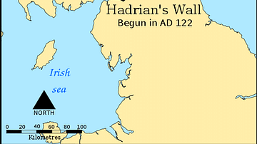
Map of the Hadrian’s wall (Vallum Hadriani) c. 122 CE

Map of the Provinces of the Roman Empire under Augustus
Map Indicating the Antonine & Hadrian Walls

Tang Dynasty Provinces c. 742 CE

Map of Roman Rule in Asia Minor, c. 200 CE

Map of the Roman Rule in the Levant, c. 200 CE
Cite This Work
APA Style
Netchev, S. (2023, June 21). Map of the Roman Rule in Britain c. 43 - 410 CE: Four Centuries of Empire at the Edge of the World. World History Encyclopedia. https://www.worldhistory.org/image/17564/map-of-the-roman-rule-in-britain-c-43---410-ce/
Chicago Style
Netchev, Simeon. "Map of the Roman Rule in Britain c. 43 - 410 CE: Four Centuries of Empire at the Edge of the World." World History Encyclopedia, June 21, 2023. https://www.worldhistory.org/image/17564/map-of-the-roman-rule-in-britain-c-43---410-ce/.
MLA Style
Netchev, Simeon. "Map of the Roman Rule in Britain c. 43 - 410 CE: Four Centuries of Empire at the Edge of the World." World History Encyclopedia, 21 Jun 2023, https://www.worldhistory.org/image/17564/map-of-the-roman-rule-in-britain-c-43---410-ce/.