
Illustration


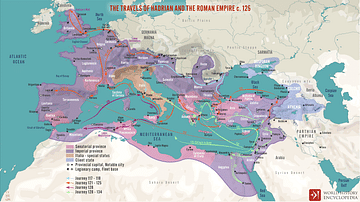
This map illustrates the later travels of Emperor Hadrian between 128 and 134 CE, highlighting his continued commitment to strengthening Rome’s frontiers and unifying its diverse provinces. These journeys took him across the eastern Mediterranean, North Africa, and the Levant, combining strategic inspection with cultural and administrative engagement.
During this period, Hadrian (reigned 117 - 138 CE) visited key cities in Greece, Asia Minor, and Egypt, where he famously founded the city of Antinopolis in memory of his companion Antinous of Bithynia (circa 110 - 130 CE). His return to the eastern provinces included time in Syria and Judea, regions facing growing unrest. Hadrian’s travels were more than symbolic; they allowed him to project imperial presence, oversee provincial affairs, and foster a shared Roman identity through architecture, civic patronage, and diplomacy. The map captures the scope of an emperor who ruled as much by movement as by decree.
About the Author

Related Images
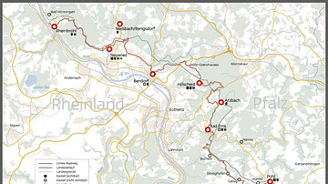
Map of the Limes in Rhineland-Palatinate, Germany
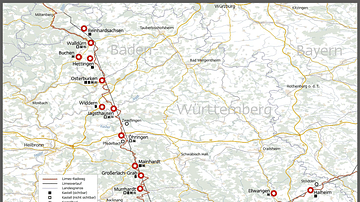
Map of the Limes in Baden Württemberg, Germany

Map of the Limes in Bavaria, Germany
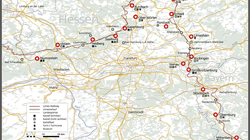
Map of the Limes in Hesse, Germany
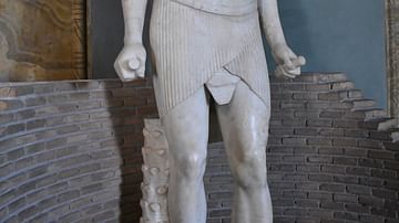
Statue of Osiris-Antinous
The Travels of Hadrian and the Roman Empire c. 125 CE
Cite This Work
APA Style
Netchev, S. (2021, December 06). The travels of Hadrian 128-134 CE. World History Encyclopedia. Retrieved from https://www.worldhistory.org/image/14938/the-travels-of-hadrian-128-134-ce/
Chicago Style
Netchev, Simeon. "The travels of Hadrian 128-134 CE." World History Encyclopedia. Last modified December 06, 2021. https://www.worldhistory.org/image/14938/the-travels-of-hadrian-128-134-ce/.
MLA Style
Netchev, Simeon. "The travels of Hadrian 128-134 CE." World History Encyclopedia. World History Encyclopedia, 06 Dec 2021, https://www.worldhistory.org/image/14938/the-travels-of-hadrian-128-134-ce/. Web. 25 Jun 2025.