


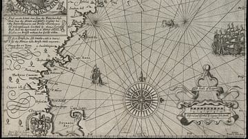
A 1665 map drawn by Johannes Vingboons of the island of São Tomé in the Gulf of Guinea in West Africa. The island was a Portuguese colony from c. 1486 to 1975. (National Archives of the Netherlands)
.jpg)
Related Images
Map of New England

Map of Westward Exploration and Settlement of the USA c.1855

Map of the Quest of Jason and the Argonauts

Map of the World in the 14th Century

Map of the Rise and Fall of the Mexica (Aztec) Empire - Alliance, Expansion, and Tribute Power in Mesoamerica

Map of the World Known to Europeans in 1000 CE
Cite This Work
APA Style
Vingboons, J. (2021, May 27). Historical Map of São Tomé. World History Encyclopedia. https://www.worldhistory.org/image/14115/historical-map-of-sao-tome/
Chicago Style
Vingboons, Johannes. "Historical Map of São Tomé." World History Encyclopedia, May 27, 2021. https://www.worldhistory.org/image/14115/historical-map-of-sao-tome/.
MLA Style
Vingboons, Johannes. "Historical Map of São Tomé." World History Encyclopedia, 27 May 2021, https://www.worldhistory.org/image/14115/historical-map-of-sao-tome/.