


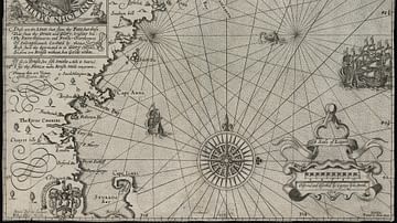
A 1635 CE map of southern Africa by Willem Janszoon Blaeu. It shows the kingdom of Monomotapa (aka Mutapa), although it inaccurately shows the kingdom's spread over a far larger area than it actually controlled around the Zambezi River.
Related Images

Map of Ancient Egypt

Map of Ancient & Medieval Sub-Saharan African States

Map of Odysseus’ 10-year Journey Home

Map of the Silk Road During the Late 8th Century
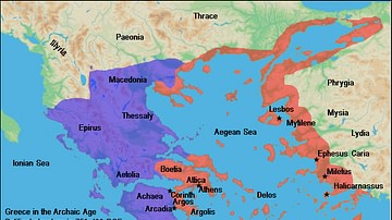
Map of Archaic Greece
Map of New England
Cite This Work
APA Style
Blaeu, W. J. (2019, March 18). Map of Mutapa. World History Encyclopedia. https://www.worldhistory.org/image/10251/map-of-mutapa/
Chicago Style
Blaeu, Willem Janszoon. "Map of Mutapa." World History Encyclopedia, March 18, 2019. https://www.worldhistory.org/image/10251/map-of-mutapa/.
MLA Style
Blaeu, Willem Janszoon. "Map of Mutapa." World History Encyclopedia, 18 Mar 2019, https://www.worldhistory.org/image/10251/map-of-mutapa/.