
Search
Search Results
Definition
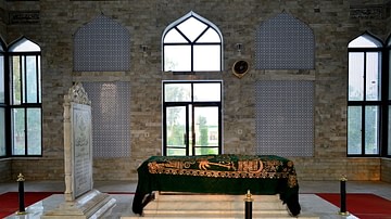
Muhammad Ghori
Shihab al-Din (also Muʿizz al-Din Muhammad ibn Sam), popularly known as Muhammad Ghori (r. 1173-1206 CE), was the Muslim ruler who laid the foundation for the subsequent Islamic ruling dynasties of India which saw its pinnacle later in the...

Image
East India Company Fort, Bombay
A c. 1665 illustration of the British East India Company's fort at Bombay (now Mumbai). (National Archives of the Netherlands, The Hague)
Definition
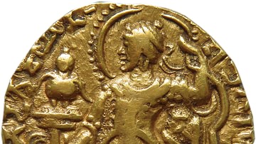
Samudragupta
Samudragupta (r. 335/350 - 370/380 CE) was the first significant ruler of the Gupta Dynasty. Having come to the throne, he decided to extend the boundaries of his empire to cover the multiple kingdoms and republics that existed outside its...

Image
India in the Vedic Age, 1500 BCE-500 BCE
A map illustrating the evolution of the cultures on the northern Indian subcontinent with the arrival of the Aryan nomads during the late Bronze Age and early Iron Age known as the Vedic age (c. 1500 – c. 500 BCE), when the Vedic literature...

Video
New Name: World History Encyclopedia!
We have some really exciting things happening, and the biggest one is our new name: World History Encyclopedia. We have covered much of the ancient world, and are now working on Medieval, Renaissance, Early Modern Europe and Colonial so it...

Image
Original Flag of the English East India Company
The original flag of the English East India Company (EIC), founded in 1600 by royal charter. The company later changed its name to the British East India Company and so the cross of St. George in the top right corner was replaced by a Union...

Video
The Fascinating Story of How the Bowie Knife Got Its Name
Check my other channel Biographics! https://www.youtube.com/channel/UClnDI2sdehVm1zm_LmUHsjQ →Some of our favorites: https://www.youtube.com/playlist?list=PLR0XuDegDqP10d4vrztQ0fVzNnTiQBEAA →Subscribe for new videos every day! https://www.youtube.com/user/TodayIFoundOut?sub_confirmation=1...

Image
Dutch East India Company Trading Regions
Map of East India, taken from the Atlas van der Hagen, Koninklijke Bibliotheek, The Hague Part 4. This map of South East Asia was published by Nicolaas Visscher II (1649-1702). The map shows the entire trading region of the Dutch East India...

Image
Map of Medieval India, c. 1360
Medieval India around the mid-14th century (c. 1360) was characterized by political fragmentation, regional consolidation, and intense interaction between Islamic sultanates and long-established Indic polities. Following the weakening of...
Image
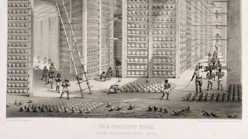
Opium Warehouse of the East India Company
A c. 1850 print showing an opium warehouse of the East India Company in Patna, India. Opium was dried into large balls and then packed into chests for transportation to China.