
Search
Remove Ads
Advertisement
Search Results

Definition
Mali Empire
The Mali Empire (1240-1645) of West Africa was founded by Sundiata Keita (r. 1230-1255) following his victory over the kingdom of Sosso (c. 1180-1235). Sundiata's centralised government, diplomacy and well-trained army permitted a massive...

Image
Late Medieval Land & Maritime Trade Routes
A map showing the late medieval trade routes by land and sea across Europe and Western Asia.

Definition
Caesarea Maritima
Caesarea Maritima was a city built over 2,000 years ago (c. 22-10 BCE) on the coast of the Eastern Mediterranean. With Roman engineering and largesse, Herod the Great (r. 37-4 BCE) accomplished this feat by constructing a whole metropolis...
Definition
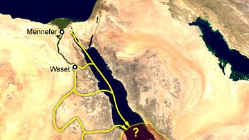
Punt
The Land of Punt was a region in Africa (most likely Somalia) referenced by inscriptions of ancient Egypt initially as a partner in trade and, later, as a semimythical country rich in resources and exotic goods. It is best known from the...

Definition
East India Company
The English East India Company (EIC or EEIC), later to become the British East India Company, was founded in 1600 as a trading company. With a massive private army and the backing of the British government, the EIC looted the Indian subcontinent...

Image
Varangian Trade Routes
Map showing Varangian trade routes.
Red: Volga trade route
Purple: trade route from the Varangians to the Greeks
Orange: Other trade routes of the 8th-11th centuries

Video
History of the Major Trade Routes - Summary on a Map
In this video, let's retrace the evolution of the world’s major trade routes, from the Incense Route until today.

Image
Slave Trade
Execrable Human Traffick, or The Affectionate Slaves, oil on canvas by George Morland, c. 1788. Depicted here is a scene of a man being abducted by slavers on the coast of Africa as his family watches. From the 16th to the 19th century...

Video
How Roman Trade with India Made the Empire Rich
This video was sponsored by Imperator: Rome. You can support our channel by buying this game via this link: https://store.steampowered.com/app/859580/Imperator_Rome/ We are continuing our new animated historical documentary series on the...

Image
Map of the Trade Networks in the Middle Ages, c. 1200
By the early 13th century (c. 1200 CE), long-distance trade networks across Eurasia and the Mediterranean had regained a level of interconnectivity not seen since late antiquity. After the political fragmentation that followed the fall of...