
Search
Did you mean: Kingdom of Benin?
Remove Ads
Advertisement
Search Results

Image
Map of the Zulu Kingdom and British Imperial Expansion - The Anglo-Zulu War - Conquest & the Struggle for Power
The Zulu Kingdom emerged in the early 19th century as a centralized and militarized state under Shaka Zulu (reign c. 1816–1828), whose reforms reshaped regional power dynamics in southeastern Africa. By the later 19th century, the kingdom...

Definition
The Westcar Papyrus
The ancient Egyptians enjoyed storytelling as one of their favorite pastimes. Inscriptions and images, as well as the number of stories produced, give evidence of a long history of the art of the story in Egypt dealing with subjects ranging...
Image
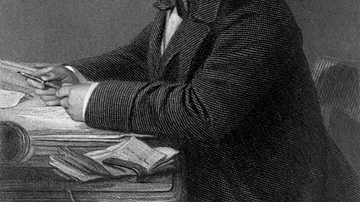
Portrait of Isambard Kingdom Brunel
A portrait of Isambard Kingdom Brunel (1806-59), the British engineer and key figure of the British Industrial Revolution (1760-1840). By John Horsley, c. 1870. (From The life of Isambard Kingdom Brunel, Civil Engineer, 1870, by Isambard...

Image
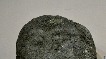
A Statuette from Old kingdom of Egypt
Only the upper half of this granite statuette of a seated man has survived. The inscriptions on the back of the statuette read "offerings given of the king to Bastet mistress of Bast for the ka of ". The inscriptions appear not to be written...
Image
Head of a Bearded Man from the Musasir Kingdom
This is the upper part of a sandstone statue which was found near Rowanduz village, modern Sulaimaniya Governorate, Iraq. The lack of inscriptions on this statue make it difficult to determine who this bearded man was. The statue is from...

Definition
Aethelwulf of Wessex
Aethelwulf (r. 839-858) was King of Wessex, a region in modern-day Britain, son and successor to Egbert of Wessex (r. 802-839), who had unified and expanded his kingdom with Aethelwulf's assistance. Aethelwulf fought at the Battle of Ellandun...

Definition
Mutapa
Mutapa (aka Matapa, Mwenemutapa, and Monomotapa) was a southern African kingdom located in the north of modern Zimbabwe along the Zambezi River which flourished between the mid-15th and mid-17th century CE. Although sometimes described as...

Image
Map of the New Kingdom of Egypt, 1450 BCE
A map showing the maximum territorial extent of the New Kingdom of Egypt, ca. 1450 BCE.

Image
Magadha Kingdom
A map showing the extent of the ancient kingdom of Magadha in India from the 6th to 4th century BCE.
Image
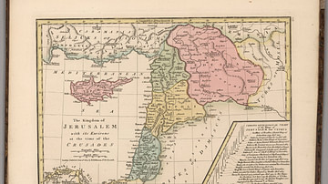
Kingdom of Jerusalem at the Time of the Crusades
This map depicts the Kingdom of Jerusalem (existed 1099-1291 CE), along with the Counties of Tripoli, Edessa, and Antioch.