
Search
Remove Ads
Advertisement
Search Results
Image
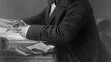
Portrait of Isambard Kingdom Brunel
A portrait of Isambard Kingdom Brunel (1806-59), the British engineer and key figure of the British Industrial Revolution (1760-1840). By John Horsley, c. 1870. (From The life of Isambard Kingdom Brunel, Civil Engineer, 1870, by Isambard...

Image
Map of the Kingdom of the Vandals (435–534 CE)
The Kingdom of the Vandals and Alans (435–534 CE) emerged as one of the most significant post-Roman states in the western Mediterranean. Founded after the Vandals, a Germanic people originally from Central Europe, and the Alans, an Iranian-speaking...

Definition
Aethelwulf of Wessex
Aethelwulf (r. 839-858) was King of Wessex, a region in modern-day Britain, son and successor to Egbert of Wessex (r. 802-839), who had unified and expanded his kingdom with Aethelwulf's assistance. Aethelwulf fought at the Battle of Ellandun...

Definition
Mutapa
Mutapa (aka Matapa, Mwenemutapa, and Monomotapa) was a southern African kingdom located in the north of modern Zimbabwe along the Zambezi River which flourished between the mid-15th and mid-17th century CE. Although sometimes described as...

Image
Map of the New Kingdom of Egypt, 1450 BCE
A map showing the maximum territorial extent of the New Kingdom of Egypt, ca. 1450 BCE.
Image
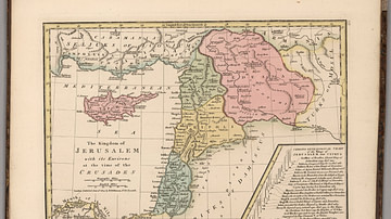
Kingdom of Jerusalem at the Time of the Crusades
This map depicts the Kingdom of Jerusalem (existed 1099-1291 CE), along with the Counties of Tripoli, Edessa, and Antioch.

Image
Royal Sceptre, Kingdom of Kongo
A gold sceptre used by the kings of the Kingdom of Kongo (14-19th century CE). 17th century CE (?). (Royal Museum of Central Africa, Brussels, Belgium)

Image
Magadha Kingdom
A map showing the extent of the ancient kingdom of Magadha in India from the 6th to 4th century BCE.
Image
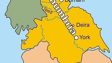
Map of the Kingdom of Northumbria
A map of the Kingdom of Northumbria (c. 604-954 CE) in the northeast of Britain c. 802 CE.

Image
Map of Kingdom of Mercia
A map showing the greatest extent of the Kingdom of Mercia (c. 527-879 CE), an Anglo-Saxon political entity located in the midlands of present-day Britain
