Search
Search Results

Definition
Ancient Egyptian Architecture
Ancient Egyptian architecture is often associated closely with the pyramids of Giza but was actually quite diverse, taking a number of forms in the construction of administrative buildings, temples, tombs, palaces, and the private homes of...

Interview
Interview: The First Black Archaeologist: A Life of John Wesley Gilbert by John Lee
John Lee joins World History Encyclopedia to tell us all about his new book, The First Black Archaeologist: A Life of John Wesley Gilbert. Kelly (WHE): Thank you so much for joining me! Let us start by talking about what the book is about...

Definition
Peloponnesian War
The Peloponnesian War between Athens and Sparta and their respective allies came in two stages: from c. 460 to 446 and from 431 to 404 BCE. With battles at home and abroad, the long and complex conflict was damaging to both sides. Sparta...

Definition
Pausanias (Geographer)
Pausanias was a Greek author, historian, and geographer of the 2nd century CE who journeyed extensively throughout Greece, chronicling these travels in his Periegesis Hellados or Description of Greece. His ten volumes of observations are...

Definition
Ancient Persia
Persia (roughly modern-day Iran) is among the oldest inhabited regions in the world. Archaeological sites in the country have established human habitation dating back 100,000 years to the Paleolithic Age with semi-permanent settlements (most...

Definition
Ancient Greek Religion
In the ancient Greek world, religion was personal, direct, and present in all areas of life. With formal rituals which included animal sacrifices and libations, myths to explain the origins of mankind and give the gods a human face, temples...

Image
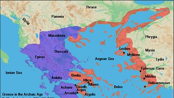
Map of Archaic Greece
A map of the political structure of Greece in the Archaic Age (ca. 750 - 490 BC).

Article
LGBTQ+ in the Ancient World
In the cultures of the ancient world, there was no need for designations such as LGBTQ+ because there was no difference noted between what is now defined as "homosexual" and "heterosexual" relationships. There was no "us" and "them" dichotomy...

Definition
Ancient Greek Literature
Greek literature has influenced not only its Roman neighbors to the west but also countless generations across the European continent. Greek writers are responsible for the introduction of such genres as poetry, tragedy, comedy, and western...

Article
Daily Life in Ancient Egypt
The popular view of life in ancient Egypt is often that it was a death-obsessed culture in which powerful pharaohs forced the people to labor at constructing pyramids and temples and, at an unspecified time, enslaved the Hebrews for this...