
Browse Content

Image
Baltic States 1100-1400 CE
This map illustrates the Baltic states in the period 1100-1400 CE.
Image
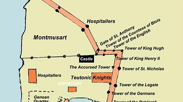
Plan of Acre, 1291 CE
A plan of the city of Acre at the time of the 1291 CE siege by the Mamluk Sultanate.
Image
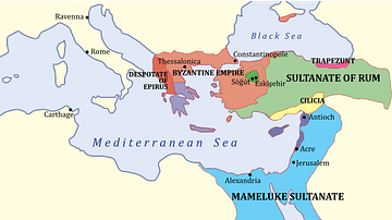
The Levant, 1263 CE
A map showing the various states of the Levant c. 1263 CE.
Light Blue: Mamluk Sultanate
Dark Blue: Latin East

Image
Crusader States 1200 CE
This map shows the crusader states c. 1200 CE.

Image
Extent of the Teutonic Order c. 1300 CE
A map indicating the commanderies and territories (shaded blue) under the control of the Teutonic Order c...

Image
The Near East in 1135 CE
This map of the Near East in 1135 CE shows four Crusader States (marked with red crosses) in relation to other powerful...
