
Browse Content

Image
Anglo-Saxon Map of the World
The "Cotton Map" is an Anglo-Saxon map of the world produced during...

Image
Map of the Portuguese Colonial Empire
This map illustrates the rise and global reach of the Portuguese...

Image
Map of the Inca Empire - Expansion and Roads
The Inca Empire (c. 13th–16th century CE) expanded from a small...
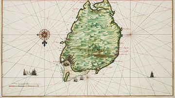
Image
Historical Map of São Tomé
A 1665 map drawn by Johannes Vingboons of the island of São Tomé...

Image
Map of Viking Exploration, 8th-11th Century
This map illustrates the sweep of Viking exploration between the...

Image
1584 Map of the Azores
A c.1584 map of the Azores archipelago in the North Atlantic. The...