
Browse Content
Image
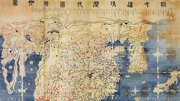
Gangnido
The Gangnido (or Kangnido) is a world map created in Korea in 1402...
Image
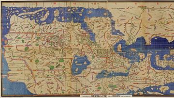
Tabula Rogeriana
The Tabula Rogeriana, as it is called in English, was made by Arab...

Image
Detail of the Tabula Peutingeriana
This detail shows a section of the Tabula Peutingeriana, a 13th...
Image
Ebstorf Map
The Ebstorf Map is a Medieval world map made by Gervase of Ebstorf...
Image
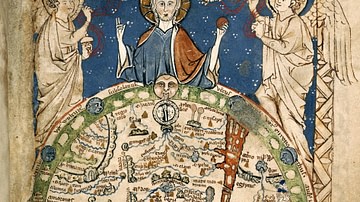
Psalter World Map
The "Psalter World Map" was made c. 1265, and depicts the world...
Image
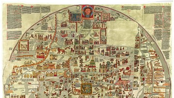
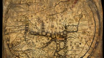
Hereford Mappa Mundi
The Hereford Mappa Mundi is a world map dating to c. 1300. It is...