
Browse Content

Image
Map of Cochin
A 1635 map of Portuguese Cochin on the southwest coast of India...

Image
Map of the Aztec Empire, c. 1427–1521 - The Rise and Fall of Mesoamerica’s Warrior Kings
This map illustrates the origins and territorial expansion of the...
Image
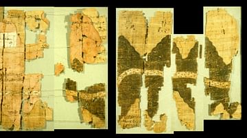
Turin Papyrus Map
The Turin Papyrus Map is an ancient Egyptian map of gold mines...
Image
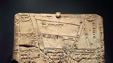
Babylonian Clay Map from Nippur
A Babylonian cuneiform tablet with a map of the fields, towns and...
Image
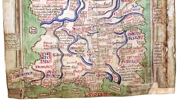
Matthew Paris' Map of Britain
Map of Great Britain by Matthew Paris (c. 1199-1259), made c. 1250...
Image
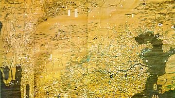
Da Ming Hunyi Tu
The Da Ming Hunyi Tu is a Chinese world map made c. 1389, during...