
Browse Content

Image
Traditional Scythian-Occupied Region East of Ukraine
A map of the traditional areas inhabited by the Scythians, stretching...
Image
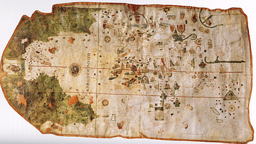
Map of the World by Juan de la Cosa
A map of the world drawn by Juan de la Cosa (c. 1450-1510). Made...

Image
Map of the Migration Period in Europe in the 4th-5th Century
The Migration Period in Europe (c. 4th–6th centuries CE) marks...
Image
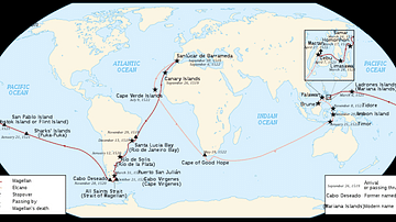
Map of Ferdinand Magellan's Circumnavigation
A map of the 1519-22 circumnavigation - the first in history -...
Image
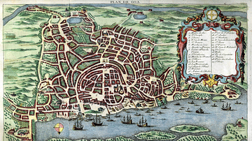
Map of Goa, c. 1750
A c. 1750 map of Portuguese Goa in India, capital of the Estado...

Image
Map of the Islamic Conquests in the 7th-9th Centuries
This map illustrates the rise and rapid expansion of Islam from...