
Browse Content
Image
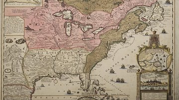
Map of New France
A map produced in 1719 showing New France. The pink area marks...

Image
Map of the Urnfield Culture c. 1300 BCE
This map illustrates the spread of the Urnfield culture in Europe...

Image
Map of the The Hallstatt Culture
A map illustrating the spread of the Hallstatt culture, a predominant...
Image
Frontiers of the Roman Empire
Map of the Roman provinces and frontiers during the reign of emperor...

Image
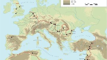
Map of the Trade Routes in the Ancient Mediterranean
This map illustrates the dynamic trade networks of the ancient...

Image
Map of the Spanish Colonial Empire
This map illustrates the rise and expansion of the Spanish Colonial...