
Browse Content

Image
Map of the Holy Roman Empire under Otto the Great c. 972
This map illustrates the emergence of the Holy Roman Empire in...

Image
Map of the Hanseatic League Trade Network, c. 1400
The Hanseatic League (c. 13th–17th centuries) was a powerful network...

Image
Map of the Carolingian Empire under Charlemagne, c. 814
The rise and expansion of the Carolingian dynasty (8th–early 9th...
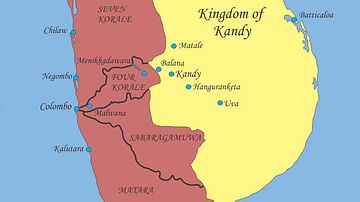
Image
Sri Lanka, Early 17th Century
Political situation in Sri Lanka, early 17th century.

Image
The Median Empire and the Ancient Near East, c. 600 BCE
A map illustrating the rise and expansion of the Median Empire...

Image
Map of Spanish Conquest & Exploration in North America
This map illustrates the expansion of Spanish imperial power following...