
Browse Content
Image
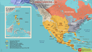
Viceroyalty of New Spain, c. 1800
A map depicting the Viceroyalty of New Spain (the first of four...
Image
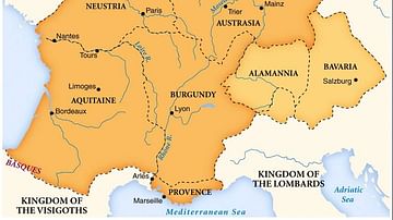
Merovingian Kingdoms
Map of the Merovingian kingdoms at their height.
Image
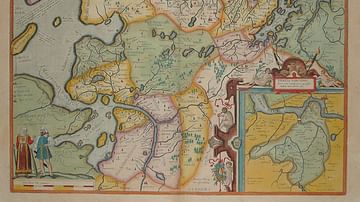
Map of East Frisia
Map of East Frisia by the Dutch Johannes Florianus (1522-1585...
Image
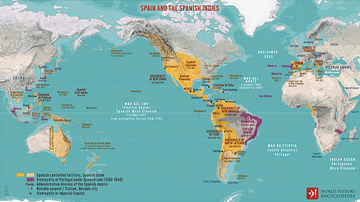
Spain and the Spanish Indies
A map illustrating one of the most significant processes of the...
Image
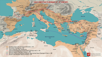
Early Christian Pilgrimage (4th- 5th century)
A map illustrating the establishment of the pilgrimage ('pilgrim'...
Image
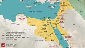
Mamluk Sultanate of Egypt c. 1330
A map illustrating the rise and evolution of the Mamluk Sultanate...