
Browse Content

Image
Map of the Trade in the Indian Ocean 15th-16th century - From Afro-Asian Exchange to European Intervention
The Indian Ocean trade network of the 15th and 16th centuries formed...

Image
Cities Founded or Renamed in Hadrian’s Name (117 -138 CE)
During the reign of Emperor Hadrian (reigned 117–138 CE), urban...
Image
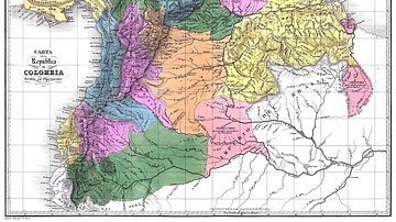
Map of Gran Colombia
A map of the Republic of Colombia (1819-1831), a state that covered...

Image
Map of Thor Heyerdahl’s Kon-Tiki Expedition, 1947
The Kon-Tiki Expedition (1947) was an experimental voyage led by...
Image
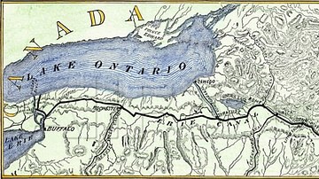
Map of Erie Canal
A map of Erie Canal c. 1840. The canal, constructed between 1817...

Image
Possible Agricultural Centers in Prehistoric China
Map showing the spatial distribution of rice, millet, and mixed...