
Browse Content

Image
Ellora Caves Map
A map of the caves and temples at Ellora, in Maharastra, central India. The structures are Hindu, Buddhist, and Jain. 6th-8th...

Image
Labelled map of Mari, modern-day Tell Hariri, Syria
A satellite photograph of the site of Tell Hariri, Syria. Tell Hariri is the site of the ancient city...

Image
Map of Diaspora Synagogues (1st - 2nd centuries CE)
This map illustrates the geographic spread of Jewish communities and synagogues across the Roman and...

Image
Map of Anglo-Saxon London
This is a map of Anglo-Saxon London between circa 500 CE and 1066 CE. The main purpose of this map is to highlight those...
Image
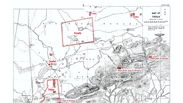
Map of Taxila
An early 20th Century map of Taxila showing the various archaeological sites in red by Sir John Marshall

Image
Chavin Civilization Map
A map showing the extent of the Chavin civilization (900-200 BCE) and its religious centre Chavin de Huantar, a celebrated...
