
Browse Content
Image
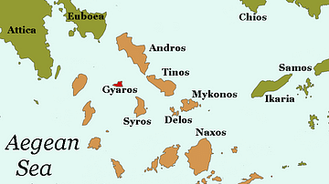
Map of Gyaros
A map of Gyaros, a barren island in the Cyclades. Gyaros' remote...

Image
Map of Mesopotamia, 2000-1600 BCE
A general map of Mesopotamia and its neighbouring territories which...

Image
Map of the Expansion of Macedon
A map showing the expansion of Macedon, around the time of the...

Image
Reproduction of Madaba Mosaic Map
Reproduction of the 6th century CE Madaba Mosaic depicting the...
Image
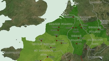
Map of the Frankish Kingdoms AD 481-511
With the accession of Clovis, son of Childeric I of the Salian...
Image
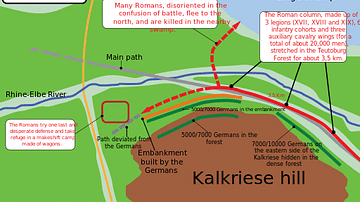
Battle of Teutoburg Forest Map
A map illustrating the troop positions of the 9 CE Battle of Teutoburg...