
Search
Remove Ads
Advertisement
Search Results

Article
Britain and the Suez Canal - 75 Years of Colonialism & Crisis
The Suez Canal in Egypt, which links the Mediterranean to the Red Sea, was taken over by the British in 1882 and was only reluctantly released 75 years later. The seizure in the 19th century caused an international furore every bit as damaging...

Image
Suez Canal Company Building, Port Said
A photograph of the Suez Canal Company Building, Port Said, Egypt. Taken during the First World War (1914-18)
Imperial War Museums

Image
Map of the Suez Canal at its Opening, c. 1869 - Engineering, Empire, and the Remaking of Global Trade
The opening of the Suez Canal on 17 November 1869 marked a major transformation in global maritime commerce, linking the Mediterranean and Red Seas through a direct sea-level canal across the Isthmus of Suez. Constructed between 1859 and...

Image
Aerial View of the Suez Canal
An illustrated aerial view of the Suez Canal in Egypt, built between 1859 and 1869. From an 1865 edition of Harper's Weekly magazine.
Image
Battleship and Felucca on the Suez Canal
A photograph showing the British battleship HMS Howe and a local felucca on the Suez Canal, Egypt. Taken during the Second World War (1939-45).
Imperial War Museums

Image
Suez War 1956
A 1956 photograph showing smoke rising from oil tanks near the Suez Canal following the Anglo-French attack on Port Said, 5 November 1956.
Imperial War Museums

Image
Men Working on the Erie Canal
Men work on the construction of the Erie Canal in Scotia, New York. While the exact date of this photograph is unknown, the construction of the canal took place between 1817 and 1825. The original Erie Canal was 363 miles (584 km) in length...
Definition
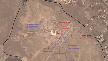
Mari
Mari was a city-state located near the west bank of the Euphrates River in Northern Mesopotamia (now eastern Syria) during the Early Bronze Age and the Middle Bronze Age. One of the earliest known planned cities, Mari is believed to have...
Image
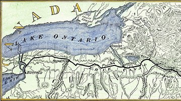
Map of Erie Canal
A map of Erie Canal c. 1840. The canal, constructed between 1817 and 1825, stretches 363 miles (584 km) from the Hudson River at Albany, New York, to Lake Erie at Buffalo, New York.

Image
Canal Boats on the North River
Canal boats on the North River (now referred to as the Hudson River) in New York, illustration by William L. Stone and Cadwallader D. Colden, issued in 1825 to be presented to the Mayor of New York City to celebrate the completion of the...