
Search
Remove Ads
Advertisement

 This answer was generated by
 Search Results
Image
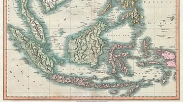
Map of the East Indies and Southeast Asia
An 1801 map of the East Indies and Southeast Asia ( Singapore, Borneo, Sumatra, Java, Philippines).

Definition
Asia Minor
Ancient Asia Minor is a geographic region located in the south-western part of Asia comprising most of present-day Turkey. The earliest reference to the region comes from tablets of the Akkadian Dynasty (2334-2083 BCE) where it was...

Image
Map of Japanese Expansion in Asia & the Pacific, 1875–1942 - Japanese Empire at Its World War II High-Water Mark
Japan’s imperial expansion developed over several decades rather than from a single fixed plan. Modernization during the Meiji era transformed Japan into...

Article
Origins of World Agriculture
Agriculture arose independently at several locations across the world, beginning about 12,000 years ago. The first crops and livestock were domesticated in six rather diffuse areas including the Near East, China, Southeast...
Image
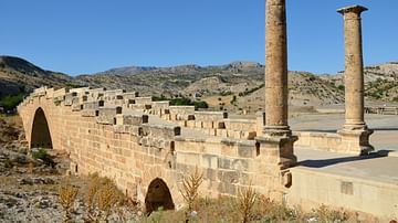
View of the Severan Bridge from the Southeast
The Severan Bridge (also known as Cendere Bridge) is a Roman bridge located near the ancient city of Arsameia (today Eskikale), 55 km (34 miles) north east of Adıyaman in southeastern Turkey. It was built...

Image
Wyndclyffe Estate, Southeast View
Wyndclyffe Estate, home of Elizabeth Schermerhorn Jones (l. 1810-1876), the New York socialite who commissioned the building in 1853 and is thought to have inspired the phrase "keeping up with the Joneses", a reference...

Image
2013 image of labelled wine jars in first Tel Kabri wine cellar towards the southeast
An image of the wine pithos at Tel Kabri's Area D-West in situ during the 2013 excavation. The pithos were excavated out after the photo and this storage room is now covered...

Image
Map of Roman Rule in Asia Minor, c. 200 CE
This map illustrates the geopolitical landscape of Asia Minor during the reign of Emperor Septimius Severus (193–211 CE), around the year 200 CE. By this time, the peninsula (modern-day Turkey) had been under...
Image
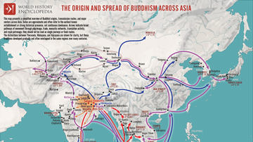
Map of the Spread of Buddhism Across Asia - The Making of a Pan-Asian Religion
Buddhism originated in the Ganges Plain of Magadha (modern Bihar, India) during the 5th–4th centuries BCE, following the enlightenment of Siddhartha Gautama, the Buddha (c. 5th...
Image
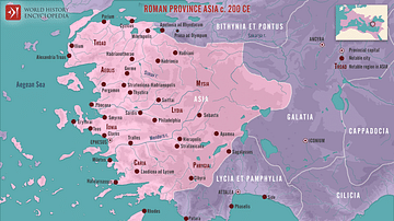
Roman Province Asia c. 200 CE
This map illustrates the Roman province of Asia around 200 CE. Established in 129 BCE following the bequest of the Attalid Kingdom of Pergamon to Rome, it encompassed western Anatolia (modern-day Turkey). It was a wealthy...
