
Search Images
Browse Content (p. 1877)
Image
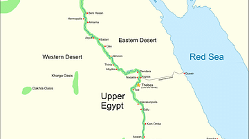
Ancient Egypt
Map of Ancient Egypt, showing the Nile up to the fifth cataract, and major cities and sites of the Dynastic period (c. 3150 BC to 30 BC). Cairo and Jerusalem are shown as reference cities.
Image
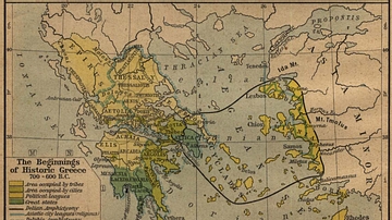
The Beginnings of Historic Greece
The Beginnings of Historic Greece. 700 - 600 B.C.
Image
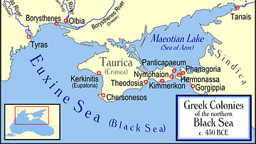
Greek Colonies of the Northern Black Sea
Map showing Ancient Greek colonies on the northern coast of the Black Sea, c. 450 BC.

Image
Babylon at the time of Hammurabi
A locator map of Hammurabi's Babylonia, showing the Babylonian territory upon his ascension in 1792 BC and upon his death in 1750 BC. The river courses and coastline are those of that time period — in general, they are not the modern rivers...
Image
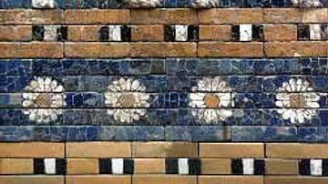
Detail of the Ishtar Gate
Detail of the Ishtar-Gate : a lion, symbol of the goddess Ishtar.

Image
Babylon at the time of the Kassites
A map of the Babylonian Empire during the time of the Kassites, roughly the 13th century BC. This map shows the probable river courses and coastline at that time.
Image
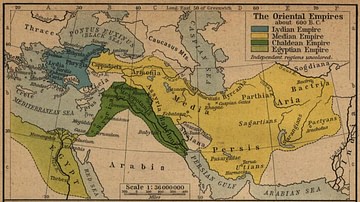
The Oriental Empires
Map showing the Median, Lydian, Chaldean, and Egyptian empires around 600 BC.

Image
Hanging Gardens of Babylon
A representation of the Hanging Gardens of Babylon, the fabled gardens which possibly adorned the capital of the Neo-Babylonian Empire, built by its greatest king Nebuchadnezzar II (r. 605-562 BCE). A 16th century CE engraving by Dutch artist...
Image
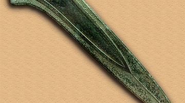
Bronze Age Sword
Ceremonial giant dirk of the Plougrescant-Ommerschans type, Plougrescant, France, 1500–1300 BC.
Image
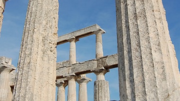
Temple of Aphaea
The ruins of the temple of Aphaea on Aegina. Aphaea was only worshipped in this temple. Pausanias (2nd century AD) writes: "On Aigina as one goes toward the mountain of Pan-Greek Zeus, the sanctuary of Aphaia comes up, for whom Pindar...