
Search Images
Browse Content (p. 1793)
Image
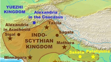
Map of the Indo-Saka Kingdoms
Map of the Indo-Saka / Indo-Scythian Kingdoms.
Image
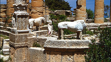
Sanctuary of Apollon in Cyrene
Ruins of the Sanctuary of Apollon in Cyrene, modern Libya.
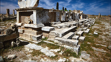
Image
Agora of Cyrene
The ruins of the agora in Cyrene, modern Libya.
Image
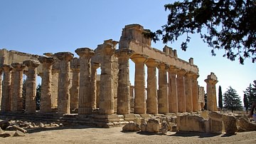
Temple of Zeus at Cyrene
Temple of Zeus at Cyrene, modern-day Libya.
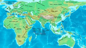
Image
The Eastern Hemisphere, 100 BC
A map showing the major empires, kingdoms, tribes, and ethnic groups of the Eastern Hemisphere in 100 BC.

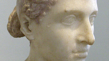
Image
Bust of Mark Antony
A bust of Marcus Antonius (Mark Antony), from the Vatican Museums.
Image
Bust of Cleopatra
Marlbe bust of Cleopatra VI of Egypt form 30-40 BC. Altes Museum Berlin.
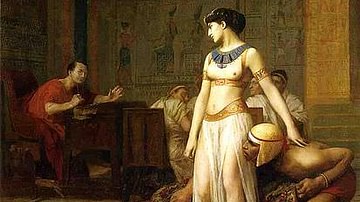
Image
Cleopatra and Caesar
Cleopatra Before Caesar by Jean-Léon Gérôme, oil on canvas, 1866. Cleopatra confronts Gaius Julius Caesar after emerging from a roll of carpet. The Egyptian Queen had been driven from the palace in Alexandria by her brother/husband Ptolemy...
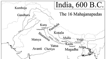
Image
Map of India, 600 BCE
Mahajanapadas (Sanskrit: महाजनपद, Mahājanapadas), literally "great realms", (from maha, "great", and janapada "foothold of a tribe", "country") were ancient Indian kingdoms or countries. Ancient Buddhist texts like Anguttara Nikaya make...

Image
Map of the Indus Valley Civilization, c.3300-1300 BCE - Harappa, Mohenjo-Daro, and the Roots of Civilization in the Bronze Age Subcontinent
This map illustrates the extent and key urban centers of the Indus Valley Civilization (circa 3300–1300 BCE), one of the world’s earliest complex societies. Spanning parts of modern-day Pakistan and northwest India, this civilization was...