
Search
Search Results
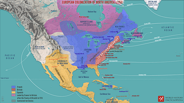
Image Gallery
5 Maps on the Origins of the United States
In this gallery of five maps, we examine the creation and expansion of the United States from the colonization of North America by European powers to the routes of the explorers who pushed ever westwards to the Pacific coast. Here we can...

Image
President Biden Signs the Juneteenth National Independence Day Act Bill
President Joe Biden, joined by Vice President Kamala Harris, lawmakers, and guests, signs the Juneteenth National Independence Day Act Bill on Thursday, June 17, 2021, in the East Room of the White House. Official White House Photo by...
Image
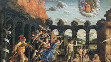
Virtue Triumphant over Vice by Mantegna
The painting Virtue Triumphant over Vice by the Italian Renaissance artist Andrea Mantegna (c. 1431-1506 CE). Completed c. 1502 CE. (Louvre, Paris)
Image
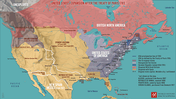
United States Expansion after the Treaty of Paris in 1783
A map illustrating the expansion of the United States of America following the Treaty of Paris (September 3, 1783), which ended the War of the American Revolution, recognized U.S. independence, and granted it sizeable additional territory...
Image
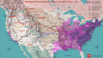
Westward Exploration and Settlement of the United States c.1850
A map illustrating the patterns and routes of westward exploration and settlement in the United States after the “Louisiana Purchase” from France in 1803. As Napoleonic dreams of a great North American Empire gave way to French hegemonic...
Image
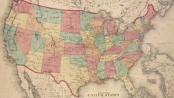
Map of the United States, 1874
A map of the United States, showing each of its states, published by D.G. Beers & Co. in 1874.
From the Lionel Pincus and Princess Firyal Map Division, The New York Public Library.

Image
Vice or Spiral Staircase, Caerphilly Castle
An example of a castle vice or spiral staircase, Caerphilly Castle, Wales. 1268-1290 CE.

Image
President Émile Loubet
A c. 1900 photograph of Émile Loubet, President of the French Republic 1899-1906.
Definition
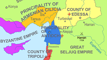
Crusader States
The Crusader States (aka the Latin East or Outremer) were created after the First Crusade (1095-1102 CE) in order to keep hold of the territorial gains made by Christian armies in the Middle East. The four small states were the Kingdom of...
Definition
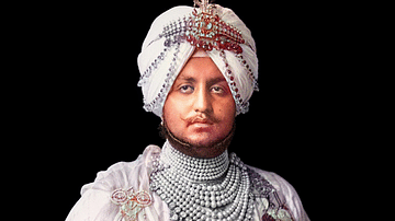
Indian Princely States
The Indian Princely states (aka Native States or Princely India) were those states in the Indian subcontinent the British did not conquer but which were typically bound by treaty first to the East India Company and then to the British Crown...