
Search
Search Results
Image
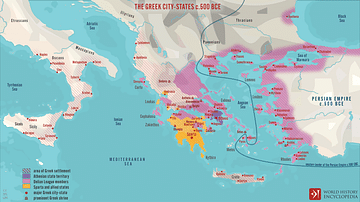
The Greek City-states c. 500 BCE
A map illustrating the city-states of Classical Greece around 500 BCE and depicting the expansion of Hellenic influence along the coasts of the Mediterranean and Black sea and the formation and scope of the Delian League, under Athenian hegemony...
Image
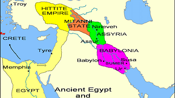
States of the Fertile Crescent, c. 1450 BCE
A map illustrating the various political states within the Fertile Crescent c. 1450 BCE.
Image
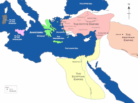
Map of the Hittite Empire and Surrounding States
A map of the Hittite Empire and surrounding states, including the Assyrian Empire, the Egyptian Empire, and Ahhiyawa.
This map is an extract from the book Empires of Bronze by Gordon Doherty, republished with permission.
Image
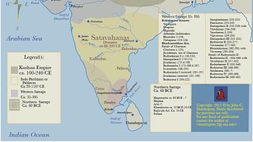
Kushan Empire & Neighboring States
This map shows the extent of the Kushan empire along with the various states and kingdoms that surrounded it at roughly the same time period. c. 100 - 240 CE.
Image
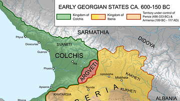
Map of Ancient Georgian States (600-150 BCE)
Map showing the ancient states in the western Caucasus (modern-day Georgia) from c. 600 BCE to 150 BCE.
Image
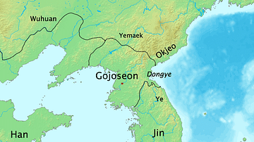
Map of Korean States in 108 BCE
A map of the Korean states in 108 BCE.
Article
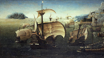
The Spice Trade & the Age of Exploration
One of the major motivating factors in the European Age of Exploration was the search for direct access to the highly lucrative Eastern spice trade. In the 15th century, spices came to Europe via the Middle East land and sea routes, and spices...
Image
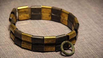
Warring States Period Dog Collar
Warring States Period dog collar.
Zhongshan State Gallery, Hebei Museum, Shijiazhuang, China.
Definition
Kikuyu People
The Kikuyu people (aka Gikuyu or Agikuyu) are a Bantu-speaking people who occupied territory in what is today central Kenya in East Africa from the 17th century onwards. They established themselves primarily as agriculturalists around Mount...
Image
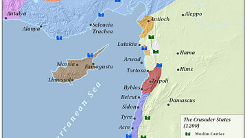
Crusader States 1200 CE
This map shows the crusader states c. 1200 CE.