
Search
Search Results
Image
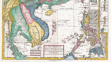
The South China Sea in the 18th Century
A late-18th century map of the South China Sea. Drawn by Rigobert Bonne and G. Raynal
Image
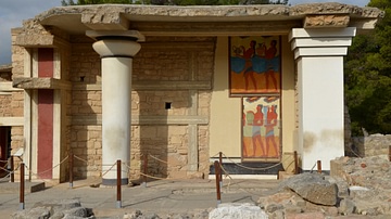
South Propylon of the Palace of Knossos
View of the restored part of the South Propylon at Knossos (Crete), decorated with copies of parts of the Procession Fresco. This Propylon formed the south entrance to the palace. The pairs of columns with their corresponding parapets supported...
Image
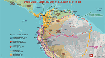
Spanish Conquest & Exploration in South America in the 16th Century
A map illustrating Spain’s drive to expand its empire in South America following the occupation of the larger Caribbean islands by 1512. The promise of gold drove the Spaniards far and wide across the continent, from the Isthmus of Panama...
Image
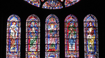
South Rose Window, Chartres Cathedral
The South Rose window of Chartres Cathedral, France, 1190-1220 CE. The stained glass window shows scenes of Jesus Christ and the Judgement of the Apocalypse.
Image
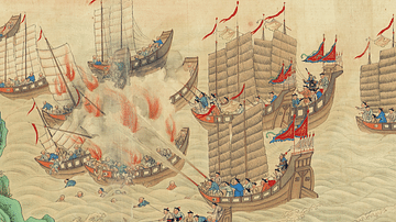
South China Sea Pirates
A Qing Dynasty (1636-1912) illustration showing pirates attacking merchant ships in the South China Sea. From the Qing Scroll. (Maritime Museum, Hong Kong)
Image
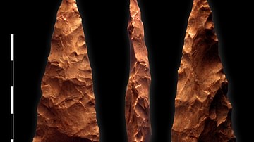
Biface from Blombos Cave, South Africa
Biface from Blombos Cave, South Africa. It belongs to the Africa Middle Stone Age (MSA) tool culture and has been dated to c. 71,000 years old.
Image
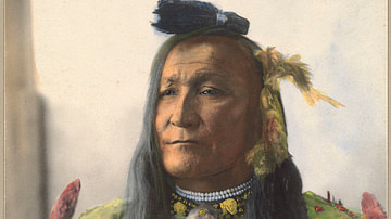
Chief Mountain Chief of the South Piegan Blackfeet
Chief Mountain Chief (Ninna-stako, l. c. 1848-1942), also known as Big Brave (Omach-katsi) and later as Frank Mountain Chief, warrior and leader of the South Piegan nation of the Blackfoot Confederacy. Chief Mountain Colorized photograph...
Image
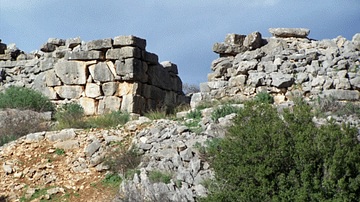
The South Gate at Gla
Ashlar masonry of the south gate at the Mycenaean site Gla, Greece, built c. 13th century BCE (Mycenaean LHIII).
Image
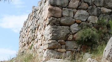
South Tower, Tiryns
Detail of the 'Cyclopean' walls of the south tower of Mycenaean Tiryns (13th century BCE).
Image
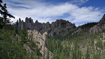
Black Hills, South Dakota
Image of the Black Hills, South Dakota, sacred land of the Sioux, as seen from Needles Highway.