


A map indicating the territories controlled by the Crusader States or Latin East from 1229 CE to 1240 CE after the Sixth Crusade (1227-1229 CE)
Related Images

Map of the Crusader States (Outremer), 1096-1291
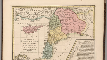
Kingdom of Jerusalem at the Time of the Crusades

Crusader States 1200 CE

Map of the First Three Crusades & the 12th-Century Outremer

Map of the First Crusade, 1096 - 1099

Map of the Latin Empire: A Crusader State in Constantinople - Imperium Romaniae and the Fragmentation of Byzantium
Cite This Work
APA Style
Ziegelbrenner. (2018, September 07). Map of the Crusader States, 1229-1240 CE. World History Encyclopedia. https://www.worldhistory.org/image/9193/map-of-the-crusader-states-1229-1240-ce/
Chicago Style
Ziegelbrenner. "Map of the Crusader States, 1229-1240 CE." World History Encyclopedia, September 07, 2018. https://www.worldhistory.org/image/9193/map-of-the-crusader-states-1229-1240-ce/.
MLA Style
Ziegelbrenner. "Map of the Crusader States, 1229-1240 CE." World History Encyclopedia, 07 Sep 2018, https://www.worldhistory.org/image/9193/map-of-the-crusader-states-1229-1240-ce/.