
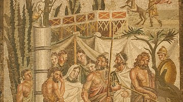
Illustration
The Bronze Age collapse at the end of the 13th century BCE saw a great many changes in the ancient world. Many second millennium states disappeared entirely, as cities were destroyed and peoples migrated. Others underwent a process of transformation which effectively turned them into new states, and some regions in western and central Anatolia remained abandoned for decades.
Until the collapse, the Hittites had been almost the only ones to record the names of the various Anatolian states, using their language to interpret those names, although many of the inhabitants of those states spoke a similar language anyway. During and after the collapse, written records became very sparse. Mycenaean Greeks were migrating into Anatolia, often destroying the established local political structure, and bringing with them their own language and oral traditions. Local names that may have first been written down by them centuries later underwent a degree of transformation in that time.
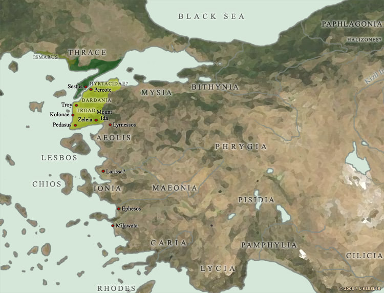
Although it seems that Greek settlers had been arriving on the western shores of Anatolia for a couple of centuries, the Trojan War in about 1183 BCE was the high point of their involvement in 'Hittite' Anatolia. Following the destruction of what seems to have been the last organised Anatolian opposition (Troy), Greek settlement of western Anatolia appears to have been largely unopposed, although the available historical data is extremely sparse.
Troy's various regional allies at the time of the Trojan War are shown here, many of which are only mentioned in later works by Homer, Herodotus, and other Greek chroniclers. Naturally, these works often use names which were familiar to their audience, but which may have been very different in the 12th century BCE. Nevertheless, the traditional names are used here. Many states, especially those outside the Troad, are historically attested, even if only poorly at first.
Related Images
Death Mask of Agamemnon
Agamemnon, Relief of Samothrace
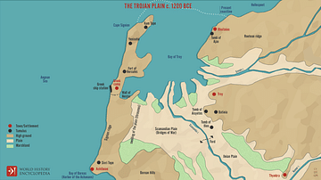
The Trojan Plain c. 1200 BCE
Myth of Iphigenia Mosaic, Empuries

Orestes & Electra
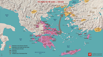
The World of the Iliad, c. 1200 BCE
References
- Cook, J M. Greek Archaeology in Western Asia Minor.
- Grote, George. History of Greece.
- John Anthony Cramer. A Geographical and Historical Description of Asia Minor, Volume 1. Nabu Press, 2010.
- John Anthony Cramer. A Geographical and Historical Description of Asia Minor, Volume 2. Nabu Press, 2010.
- Marc Van De Mieroop. A History of the Ancient Near East ca. 3000 - 323 BC. Wiley-Blackwell, 2006.
Cite This Work
APA Style
Kessler, P. L. (2012, April 26). Map of the Trojan War States, c. 1200 BCE. World History Encyclopedia. Retrieved from https://www.worldhistory.org/image/589/map-of-the-trojan-war-states-c-1200-bce/
Chicago Style
Kessler, P L. "Map of the Trojan War States, c. 1200 BCE." World History Encyclopedia. Last modified April 26, 2012. https://www.worldhistory.org/image/589/map-of-the-trojan-war-states-c-1200-bce/.
MLA Style
Kessler, P L. "Map of the Trojan War States, c. 1200 BCE." World History Encyclopedia. World History Encyclopedia, 26 Apr 2012. Web. 19 Apr 2024.