
Illustration


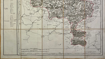
This antique map, spanning present-day Belgium and the Netherlands, represents the Meuse-Inférieure department under the First French Empire. It was created in the early 19th century by French geographer Pierre-Gilles Chanlaire and forms part of the Atlas National de France. The map illustrates the administrative structure imposed by Napoleonic authorities in this cross-border region.
About the Author

Related Images

Map of the Sambre-et-Meuse Department

Map of the World in the 14th Century
Map of the Jemappes Department
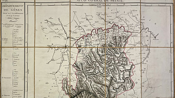
Map of the Genoa Department
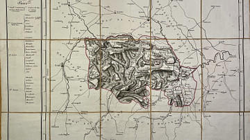
Map of the Mont-Tonnerre Department
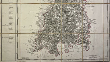
Map of the Marengo Department
Cite This Work
APA Style
Denis, L. (2025, June 10). Map of the Meuse-Inférieure Department. World History Encyclopedia. Retrieved from https://www.worldhistory.org/image/20512/map-of-the-meuse-inferieure-department/
Chicago Style
Denis, Léopold. "Map of the Meuse-Inférieure Department." World History Encyclopedia. Last modified June 10, 2025. https://www.worldhistory.org/image/20512/map-of-the-meuse-inferieure-department/.
MLA Style
Denis, Léopold. "Map of the Meuse-Inférieure Department." World History Encyclopedia. World History Encyclopedia, 10 Jun 2025, https://www.worldhistory.org/image/20512/map-of-the-meuse-inferieure-department/. Web. 23 Jun 2025.