
Server Costs Fundraiser 2026


Map of the route of Willem Janszoon's (c. 1570-c. 1630) expedition 1605-1606. The Dutch explorer made landfall at Pennefather River, near modern-day Weipa on the west coast of the Cape York peninsula (northern Queensland, Australia) on 26 February 1606.
Related Images

1598 Map of the Three Arctic Voyages (1594–1596) by Willem Barentsz

Willem de Vlamingh
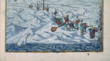
A Depiction of Willem Barentsz's Three Voyages

Map of Thor Heyerdahl’s Kon-Tiki Expedition, 1947
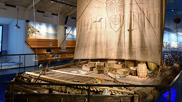
Front View of the Kon-Tiki Expedition Raft
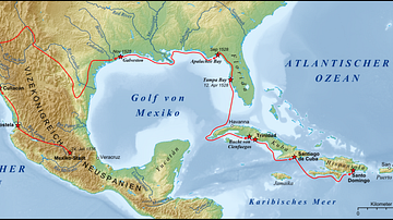
Narvaez Expedition
Cite This Work
APA Style
Lencer. (2022, January 22). Willem Janszoon's Expedition 1605-1606. World History Encyclopedia. https://www.worldhistory.org/image/15175/willem-janszoons-expedition-1605-1606/
Chicago Style
Lencer. "Willem Janszoon's Expedition 1605-1606." World History Encyclopedia, January 22, 2022. https://www.worldhistory.org/image/15175/willem-janszoons-expedition-1605-1606/.
MLA Style
Lencer. "Willem Janszoon's Expedition 1605-1606." World History Encyclopedia, 22 Jan 2022, https://www.worldhistory.org/image/15175/willem-janszoons-expedition-1605-1606/.