
Illustration
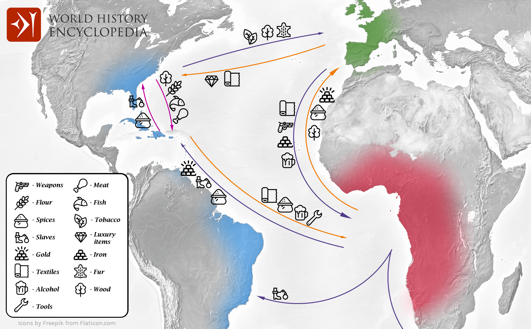
Map showing the flow of goods and enslaved people across the Atlantic between Europe, Africa and America in the transatlantic triangular trade which the European colonial powers operated from the 16th to the 19th centuries CE. This triangular trade system facilitated the Columbian Exchange by moving goods, populations and plant species between the continents.
About the Author

Related Images
Map of Ancient & Medieval Sub-Saharan African States
Diagram of the Brooks Slave Ship
Colonial Sugar Cane Manufacturing

Slave Cabin Interior, Mount Vernon
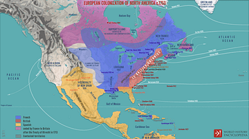
European Colonization of North America c.1750

Colonial Slave Quarters, Mount Vernon
Cite This Work
APA Style
Lalonde, O. (2021, March 28). Transatlantic Triangular Trade Map. World History Encyclopedia. Retrieved from https://www.worldhistory.org/image/13739/transatlantic-triangular-trade-map/
Chicago Style
Lalonde, Olivier. "Transatlantic Triangular Trade Map." World History Encyclopedia. Last modified March 28, 2021. https://www.worldhistory.org/image/13739/transatlantic-triangular-trade-map/.
MLA Style
Lalonde, Olivier. "Transatlantic Triangular Trade Map." World History Encyclopedia. World History Encyclopedia, 28 Mar 2021. Web. 25 Apr 2024.