
Search
Remove Ads
Advertisement
Search Results

Definition
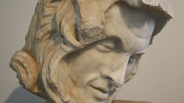
Artaxerxes I
Artaxerxes I (r. 465-424 BCE) was the sixth monarch of the Achaemenid Persian Empire. He was the son of Xerxes I (r. 486-465 BCE) and his principal wife Amestris (d. 424 BCE) and grandson of Darius I (the Great, r. 522-486 BCE). He continued...

Image Gallery
5 British Royal Houses
In this gallery, we look at the history of the last five royal houses of Britain through their family trees. From the Wars of the Roses to the current House of Windsor, we see an evolution from absolute rule to a constitutional monarchy...

Image
Inca Road System
A map of the Inca road system which included some 40,000 km of routes.
Image
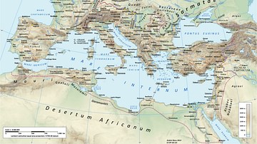
Roman Road Network
A map showing the principal routes of the Roman road network in 125 CE.
Image
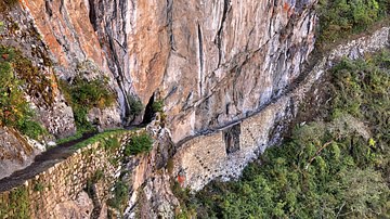
Inca Road & Bridge
An Inca mountain road with bridge, approaching Machu Picchu.

Image
Roman Road Surface
A section of a Roman road with a typical polygonal stone surface. The stones also show the ruts made by Roman wheeled vehicles. This section is beneath the Arco dei Gavi, a 1st century CE arch in Verona, Italy.
Image
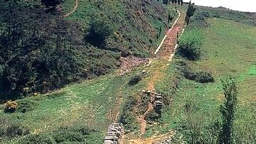
Roman Road, Spain
A section of surviving Roman road near Cirauqui in northern Spain. The curb stones can be clearly seen, a common feature of Roman roads.
Image
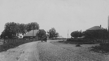
Macadamised Road
A photograph of a macadamised road taken in the 1850s. The macadamised road, that is, a hard and relatively smooth road surface made using two layers of stones (one aggregate layer and a top layer of very small stones), was first made on...

Image Gallery
The Royal Tombs of Fontevraud Abbey
Fontevraud Abbey in the Pays de la Loire region of France was founded in 1101 by Robert D'Arbrissel. This area of France was then controlled by the English Crown. Eleanor of Aquitaine (l. c. 1122-1204) retired to the abbey in 1200, and she...
Definition
Peace of Callias
The Peace of Callias (aka Kallias) refers to a possible peace treaty made in the mid-5th century BCE between Athens and Persia following the Persian Wars. The existence of such a treaty is not agreed upon by all historians, and if it did...