
Search
Remove Ads
Advertisement
Search Results

Image
Map of the New Kingdom of Egypt, 1450 BCE
A map showing the maximum territorial extent of the New Kingdom of Egypt, ca. 1450 BCE.

Image
Map of New France, 1750 CE
A map of New France c. 1750 CE within the context of European colonies in North America.

Image
New England, 1665 CE
Map of New England printed by John Seller John in 1675 CE, based on William Reed's original survey of 1665 CE.

Image
New World Native Plants
New World native plants. Clockwise, from top left: 1. Maize (Zea mays); 2. Tomato (Solanum lycopersicum); 3. Potato (Solanum tuberosum); 4. Vanilla (Vanilla); 5. Pará rubber tree (Hevea brasiliensis); 6. Cacao (Theobroma cacao); 7...
Image
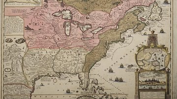
Map of New France
A map produced in 1719 showing New France. The pink area marks the territory of Canada.
Image
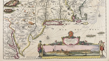
Map of New Netherland
Map of the New Netherland colonies c. 1696 and 1701 CE, by Justus Danckerts. Collection of the Municipal Library of Trento.

Image
New Orleans Battle Map
A depiction of the British assault during the Battle of New Orleans (8 Jan 1815). By the History Dept. of the United States Military Academy.
Image
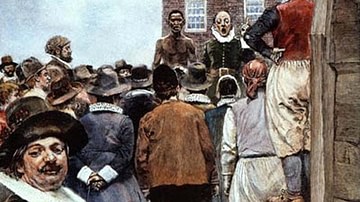
First Slave Auction in New Amsterdam, 1655 CE
"Slave Auction, 1655: First Slave Auction in New Amsterdam" by Howard Pyle, 1895 CE.
Image
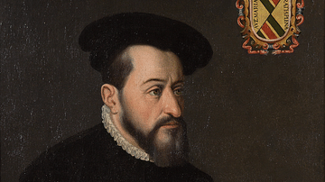
Antonio de Mendoza, Viceroy of New Spain
A portrait of Antonio de Mendoza, the first viceroy of New Spain (Mexico and many surrounding territories) within the Spanish empire. He served from 1535 to 1550. (Museo Nacional de Historia, Mexico City)
Image
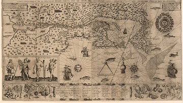
Map of New France, 1612 CE
Map of New France 1612 CE by Samuel de Champlain (1567?-1635 CE).
National Library of France.