
Search
Did you mean: Aria?
Remove Ads
Advertisement
Search Results
Collection
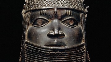
The Empires of West Africa
The ancient and medieval Mediterranean might have been a bustling stage of ever-changing empires but, across the inhospitable barrier of the Sahara Desert, West Africans were equally busy building up and toppling down their own kingdoms and...

Image
Map of Africa in World War II
Africa became a central arena in the global struggle of the Second World War (1939–1945), where imperial rivalry, strategic geography, and colonial governance converged. Campaigns in North Africa (1940–1943) pitted Axis forces, initially...

Definition
Operation Torch
Operation Torch (aka the North Africa landings) landed Allied troops in French Morocco and Algeria on 8 November 1942 with the aim of removing German and Italian forces from North Africa. The first jointly-planned Allied operation of the...

Image
Map of the Scramble for Africa after the Berlin Conference
The Berlin Conference (1884–1885), also known as the Congo Conference, marked a defining moment in the Scramble for Africa—the competitive colonization of the continent by European powers during the late 19th century. Convened in Berlin under...

Image
Map of European Exploration of Africa, c. 1434-1877 - From Coastal Voyages to Continental Expeditions
From the voyages of the Portuguese navigators under the patronage of Henry the Navigator in the 15th century to the transcontinental expeditions of Henry Morton Stanley in the 1870s, European exploration of Africa gradually transformed European...

Image
Map of Roman North Africa - Provinces, Roads & Frontiers - Expansion, administration & economic foundations 146 BCE–395
Roman involvement in North Africa began with the destruction of Carthage in the Third Punic War (149-146 BCE), after which Rome established the province of Africa and gradually expanded its authority across the Maghreb. Over the following...

Image
Map of Africa after the Treaty of Versailles, c.1920
In the aftermath of World War I (1914–1918), Africa remained overwhelmingly under European colonial domination, despite widespread African participation in the war effort. While the conflict weakened several European powers, it did not dismantle...

Image
Map of WWII North Africa Campaign, 1940-1943
The North Africa Campaign (1940–1943) formed a decisive theater of the World War II (1939–1945), centered on control of the strategic corridor linking the Mediterranean Sea to the Suez Canal and the Middle Eastern oil fields. The conflict...
Image
Torch - The North Africa Landings
A photograph showing Allied troops landing in Algeria, North Africa as part of Operation Torch, the Allied North Africa Landings of November 1942. (Imperial War Museums)

Image
Askari Troops, German East Africa
A photograph showing a parade of African Askari troops commanded by German officers in German East Africa. Taken some time during the First World War (1914-18).
German Federal Archives