
Search
Remove Ads
Advertisement
Search Results

Image
Map of the Hanseatic League Trade Network, c. 1400
The Hanseatic League (c. 13th–17th centuries) was a powerful network of merchant guilds and cities that dominated trade across northern Europe for centuries. Emerging in the late Middle Ages, the League united towns from Lübeck, Hamburg...

Article
Origin Tales of the Penobscot Nation
The Penobscot are a Native American nation of the modern-day State of Maine, also recognized as a First Nation of Canada. Along with the Abenaki, Mi'kmaq, Passamaquoddy, and Wolastoqiyik, they form the Wabanaki Confederacy. Their origin tales...

Definition
Ferdinand Magellan
Ferdinand Magellan, or Fernão de Magalhães (c. 1480-1521), was a Portuguese mariner whose expedition was the first to circumnavigate the globe in 1519-22 in the service of Spain. Magellan was killed on the voyage in what is today the Philippines...

Article
The Roman Empire in West Africa
At its fullest extent, the Roman Empire stretched from around modern-day Aswan, Egypt at its southernmost point to Great Britain in the north but the influence of the Roman Empire went far beyond even the borders of its provinces as a result...

Image
Map of the Roman Trade Network (1st - 3rd centuries CE)
This map illustrates the main maritime and overland trade arteries that bound the Roman Empire together between the first and third centuries CE. From grain fleets in the Mediterranean to camel caravans across the desert and river barges...
Definition
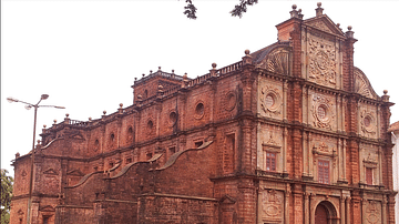
Portuguese Goa
Goa, located on the west coast of India, was a Portuguese colony from 1510 to 1961. The small coastal area was conquered by Afonso de Albuquerque (c. 1453-1515) and became an important trade hub for the Eastern spice trade. Goa was the capital...

Image
Map of the Trade in the Indian Ocean 15th-16th century - From Afro-Asian Exchange to European Intervention
The Indian Ocean trade network of the 15th and 16th centuries formed one of the most extensive and dynamic systems of exchange in the premodern world, linking East Africa, the Middle East, South Asia, and Southeast Asia. This maritime system...

Article
Cutty Sark - Fastest Ship in the World
With thousands of square feet of canvas capturing every breath of the trade winds, a 19th-century tea clipper was the absolute pinnacle of sailing evolution. The Cutty Sark was just such a ship, carrying tea and then wool across the far-flung...

Definition
Portuguese Nagasaki
Nagasaki, on the northwest coast of Japan’s Kyushu Island, was an important Portuguese trading base from c. 1571 to 1639, and the most eastern outpost of the Portuguese empire. The Portuguese presence transformed Nagasaki from a small fishing...

Image
African Slave Trade, c. 1500-1900
African Slave Trade, map by KuroNekoNiyah, 2021. This map provides an overview of the slave trade out of Africa, c. 1500-1900, showing both transatlantic and ancillary global flows. It is based on Map I from Atlas of the Transatlantic Slave...
