
Search
Remove Ads
Advertisement
Search Results

Image
The South China Sea in the 18th Century
A late-18th century map of the South China Sea. Drawn by Rigobert Bonne and G. Raynal

Image
Map of the Spanish Conquest & Exploration in South America
Spain’s rapid expansion into South America followed the consolidation of its Caribbean footholds by 1512, marking a decisive shift from exploration to imperial conquest. Under the reign of Ferdinand II of Aragon (reign1479–1516) and later...

Image
Powder Horn Depicting Charles Town, South Carolina, 1770
Powder horn depicting Charles Town, South Carolina, 1770. Used for carrying gunpowder, this pre-Revolution powder horn is engraved with the fortified city of Charles Town (now Charleston), along with a fleet of ships in the harbour (not...
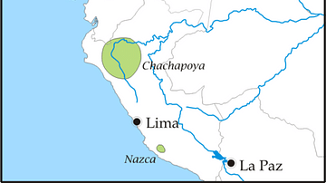
Image
Pre-Columbian Tribes of Northern South America
A map highlighting the areas of settlement of various pre-Columbian civilizations in the northern areas of South America such as the Muisca, Tairona, and Quimbaya

Image
South China Sea Pirates
A Qing Dynasty (1636-1912) illustration showing pirates attacking merchant ships in the South China Sea. From the Qing Scroll. (Maritime Museum, Hong Kong)

Image
South African Patrol, Western Desert Campaign
A July 1941 photograph showing a South African desert patrol in North Africa during the Western Desert Campaigns of the Second World War (1939-45). (Imperial War Museums)

Image
South African Troops Minesweeping
South African troops training looking for enemy mines during the Western Desert Campaigns (June 1940 to January 1943) in North Africa. (Imperial War Museums)

Article
Treasures of Roman Tunisia - 10 Key Sites Explored
Set on the North African coast, Tunisia is home to some of the finest Roman ruins in the Mediterranean. After the fall of Carthage, Rome transformed the region into the prosperous province of Africa, enriched by its fertile plains and bustling...

Image
Map of European Exploration of Africa, c. 1434-1877 - From Coastal Voyages to Continental Expeditions
From the voyages of the Portuguese navigators under the patronage of Henry the Navigator in the 15th century to the transcontinental expeditions of Henry Morton Stanley in the 1870s, European exploration of Africa gradually transformed European...

Image
Map of Roman North Africa - Provinces, Roads & Frontiers - Expansion, administration & economic foundations 146 BCE–395
Roman involvement in North Africa began with the destruction of Carthage in the Third Punic War (149-146 BCE), after which Rome established the province of Africa and gradually expanded its authority across the Maghreb. Over the following...