
Search
Remove Ads
Advertisement
Search Results

Image
Map of the Scramble for Africa after the Berlin Conference
The Berlin Conference (1884–1885), also known as the Congo Conference, marked a defining moment in the Scramble for Africa—the competitive colonization of the continent by European powers during the late 19th century. Convened in Berlin under...

Image Gallery
A Gallery of North American Plains Indians
The Great Plains of North America were once home to over 30 distinct Native American nations now referred to as the Plains Indians, Native Americans of the Plains and Prairie, and Indigenous Peoples of the Great Plains. Their descendants...
Definition
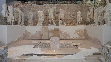
Roman Imperial Cult
The Roman imperial cult was the practice of venerating Roman emperors and their families as having divine attributes, honoring their contributions to the spread of Roman religion and culture. It was instituted by the first Roman emperor Augustus...
Image
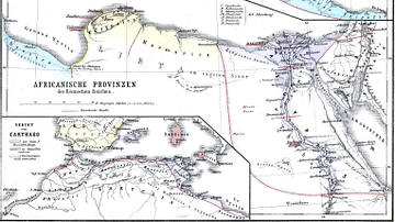
Map of Roman Africa
Nothern Africa under Roman rule. From H.Kiepert (1879), Historischer Schulatlas.

Definition
Roman Naval Warfare
Military supremacy of the seas could be a crucial factor in the success of any land campaign, and the Romans well knew that a powerful naval fleet could supply troops and equipment to where they were most needed in as short a time as possible...

Article
Origins of World Agriculture
Agriculture arose independently at several locations across the world, beginning about 12,000 years ago. The first crops and livestock were domesticated in six rather diffuse areas including the Near East, China, Southeast Asia, and Africa...

Definition
Ptolemy of Mauretania
Ptolemy of Mauretania (r. 23-40 CE) was king of Mauretania and one of the last surviving members of the Ptolemaic dynasty. His father Juba II (c. 48 BCE to 23 CE) was a Numidian royal and his mother Cleopatra Selene II (40 to c. 5 BCE) was...

Article
Exploring Roman Morocco
Morocco, then known as Mauretania, was annexed by the Roman Empire in 40 CE. The Romans in Morocco left a vast legacy with archaeological sites that dot the country's northern landscape, especially Volubilis, with its vestiges of Roman houses...

Definition
Roman Britain
Britain was a significant addition to the ever-expanding Roman Empire. For decades, Rome had been conquering the Mediterranean Sea – defeating Carthage in the Punic Wars, overwhelming Macedon and Greece, and finally marching into Syria and...

Definition
Portuguese Angola
Portuguese Angola in southwest Africa was the first European colony on that continent. While settlement from 1571 proved problematic in the interior, the Portuguese did obtain a large number of slaves which they shipped to their Atlantic...