
Browse Content

Image
Map of Spanish Main & West Indies c.1720 - Spain, France, England, and the Dutch in a Struggle Over Trade, Treasure, and Empire
This map captures the shifting tides of colonial power in the 1700s...
Image
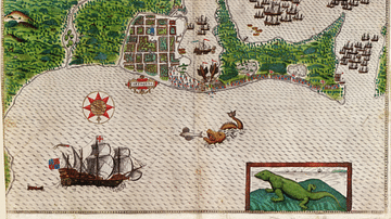
Cartagena on the Spanish Main
A c. 1589 map showing the port of Cartagena on the Spanish Main...

Image
Map of the Travels of Hadrian & the Roman Empire c. 125 CE
This map illustrates the Roman Empire under Emperor Hadrian (r...

Image
Map of Jeanne d'Arc's Route & The Hundred Years' War c. 1429
This map illustrates the Hundred Years’ War (1337–1453) at its...
Image
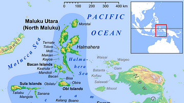
Maluku Islands in Indonesia
Location of the so-called Spice Islands, or the Maluku Islands...
Image
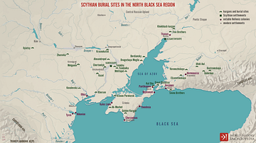
Scythian Burial Sites in the North Black Sea Region
A map illustrating the current archeological evidence for the spread...