
Browse Content

Image
Map of the Russian Revolution of 1905
This map illustrates the Russian Revolution of 1905, a wave of...

Image
Map of the Russian Empire on the Eve of World War I, 1914 - A Eurasian Giant at the Brink
The Russian Empire on the eve of World War I (1914) represented...

Image
New Orleans Battle Map
A depiction of the British assault during the Battle of New Orleans...
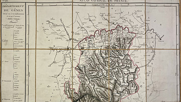
Image
Map of the Genoa Department
This antique map of Italy represents the Genoa department under...
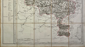
Image
Map of the Jemappes Department
This antique map of Belgium depicts the Jemappes department under...
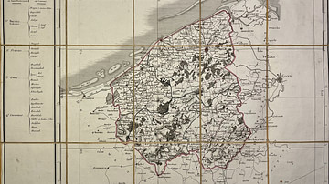
Image
Map of the Lys Department
This antique map of Belgium represents the Lys department under...