
Browse Content

Image
Map of the Indo-Saka Kingdoms
Map of the Indo-Saka / Indo-Scythian Kingdoms.
Image
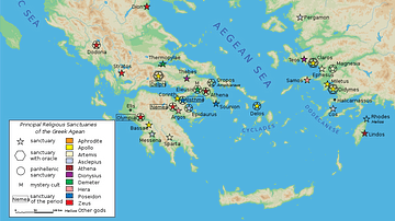
Map of Classical Greek Sanctuaries
Map of the main religious sanctuaries of classical Greece. The...

Image
Map of the Ptolemaic World
A map showing the known world at the time of the Ptolemaic Empire...
Image
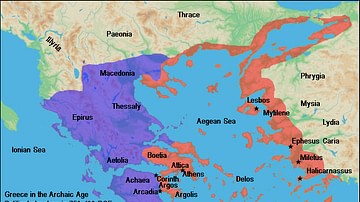
Map of Archaic Greece
A map of the political structure of Greece in the Archaic Age (ca...

Image
Map of Greece under Theban Hegemony
A map showing ancient Greece at the time of Theban hegemony, 371...
Image
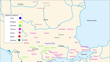
Map of the Tribes in Thrace
A map showing the major tribes in Thrace and the surrounding regions...