
Search Images
Browse Content (p. 676)

Image
Capture of the Nuestra Señora de Cavadonga
A detail of the Capture of the Spanish galleon Nuestra Señora de Cavadonga by the British ship HMS Centurion, a 1743 oil panting by Samuel Scott. (Royal Museum, Greenwich, London)
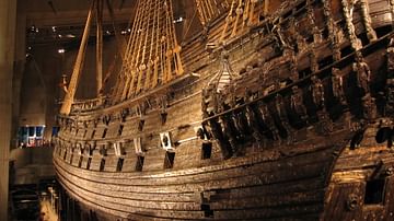
Image
Vasa Galleon
The Swedish galleon Vasa, built in the first quarter of the 17th century, sunk in 1628 and rescued in 1961. (Vasa Museum, Stockholm)
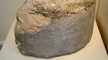
Image
Cynisca's Inscription
Inscribed circular stone base of a four-horse chariot dedicated by Cynisca of Sparta, winner of chariot races, made by Apelles of Megara, from Olympia, after 390-380 BCE.
Archaeological Museum, Olympia.

Image
Cantino World Map
The 1502 Cantino World Map, acquired by Alberto Cantino from a Portuguese original in Lisbon. The map shows the world as then known to Europeans and indicates the line decided by the 1494 treaty of Tordesillas which demarcated two spheres...
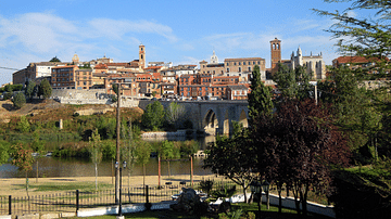
Image
Tordesillas, Spain
A view of the medieval town of Tordesillas in northwest Spain. The town gave its name to the famous 1494 treaty of Tordesillas, signed between Spain and Portugal, which divided the world into two spheres of influence.
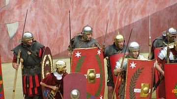
Image
Reenactors of Legio I Adiutrix
Reenactors of Legio I Adiutrix, 2017.
Image
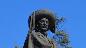
Bust of Henry the Navigator
A statue bust of Prince Henry the Navigator (aka Infante Dom Henrique, 1394-1460). Faro, Portugal.
(image cropped)
Image
Tomb of Henry the Navigator
The tomb of Prince Henry the Navigator (aka Infante Dom Henrique, 1394-1460) in Batalha monastery, central Portugal.

Image
Portuguese Carrack
An illustration of a Portuguese carrack ship from a 16th-century map. (Digital Library, University of Minnesota)

Image
Periplus of the Erythreaen Sea
Trade routes of the ancient Romans to Africa and India as described in the 1st-century CE Periplus of the Erythreaen Sea.