
Search Images
Browse Content (p. 584)
Image
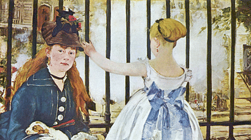
The Railway Station by Manet
An 1872-3 oil on canvas painting, The Railway Station, by Edouard Manet (1832-83), the French modernist painter. Another of Manet's puzzles. The station itself (Paris' Gare St. Lazare) is not shown here at all, only the steam from the trains...
Image
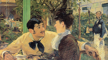
At Père Lathuille's by Manet
An 1879 oil on canvas painting, Chez le père Lathuille (At Père Lathuille's), by Edouard Manet (1832-83), the French modernist painter. With the setting as one of the artist's favourite café-restaurants, the relationship between the central...
Image
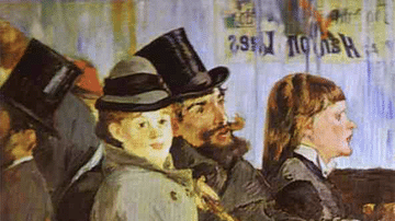
At the Café by Manet
An 1878 oil on canvas painting, Au Café (At the Café), by Edouard Manet (1832-83), the French modernist painter. One of the most famous examples of Manet's technique of showing individuals physically close but completely disconnected from...
Image
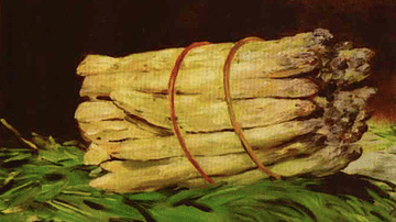
Bunch of Asparagus by Manet
An 1880 oil on canvas still life, Bunch of Asparagus, by Edouard Manet (1832-83), the French modernist painter. Manet was particularly interested in still life, especially towards the end of his career. The work was bought by the editor of...
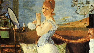
Image
Nana by Manet
An 1876-7 oil on canvas painting, Nana, by Edouard Manet (1832-83), the French modernist painter. Another painting that shocked the Establishment as Manet shows off an obvious courtesan. Manet's model for Nana was Henriette Haser, mistress...

Image
Blue Venice by Manet
An 1875 oil on canvas painting, Blue Venice, by Edouard Manet (1832-83), the French modernist painter. Manet visited Venice in 1875 and produced some of his most impressionistic paintings. Apparently, Manet postponed his departure from the...
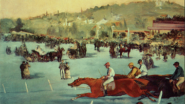
Image
Horse Racing by Manet
An 1872 oil on canvas painting, Horse Racing, by Edouard Manet (1832-83), the French modernist painter. The was a work commissioned by a racing enthusiast. Manet was a frequent race-goer himself, particularly the races held at the Bois de...
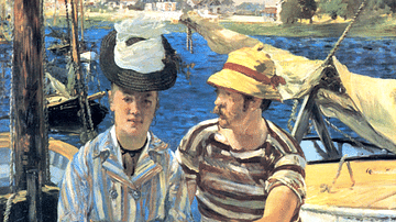
Image
Argenteuil by Manet
An 1874 oil on canvas painting, Argenteuil, by Edouard Manet (1832-83), the French modernist painter. Painted at Argenteuil on the Seine. It was painted when Manet was working alongside Claude Monet, and the lighter palette than usual is...
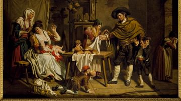
Image
The Self-Sacrifice of a Father
The Self-Sacrifice of a Father, painting by Jacques Sablet, second half of the 18th century.
Nationalmuseum, Stockholm.
Image
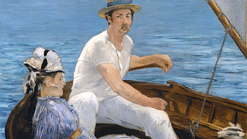
Boating by Manet
An 1874 oil on canvas painting, Boating, by Edouard Manet (1832-83), the French modernist painter. Painted at Argenteuil on the Seine. Typical of Manet's work, the two figures seem disconnected from each other, and the scene is very flat...