
Search Images
Browse Content (p. 1883)
Image
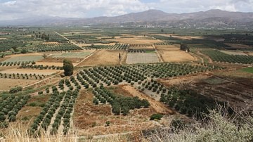
Mesara Plain, Crete
A view from Phaistos over the Mesara plain in Crete.
Image
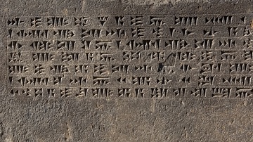
Urartian Cuneiform
Urartian cuneiform inscription on the left of the temple door at Erebuni Fortress.
Image
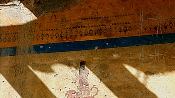
Urartian Wall Paintings
Modern reproductions of the ancient wall-paintings at Erebuni Fortress.
Image
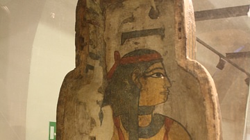
Sarcophagus Interior Lid
Plastered and painted wood lid interior of the anthropoid coffin of Pa-di-Khonsu XXII-XXIV dynasty, Thebes. (Egyptian Museum, Castello Sforzesco, Milan)
Image
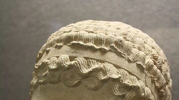
Egyptian Sphinx Head
Limestone sphinx head from the Ptolemaic period, Medinet Madi, Temple of Isis-Thermutis. (Egyptian Museum, Castello Sforzesco, Milan)
Image
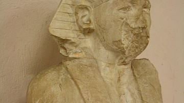
Amenemhat III
Limestone statue (seated) of Amenemhat III, XII Dynasty, Medinet Madi, Temple of Isis-Thermutis. (Egyptian Museum, Castello Sforzesco, Milan)
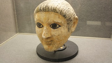
Image
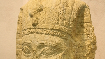
Ptolemaic King
Limestone head of Ptolemaic King, 2nd to 1st century BCE, Medinet Madi. (Egyptian Museum, Castello Sforzesco, Milan)

Image
Egyptian Scribe's Palette
A wooden scribe's palette from the New Kingdom, Egpyt. (Egyptian Museum, Castello Sforzesco, Milan)
Image
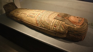
Egpytian Sarcophagus
Plastered and painted wood sarcophagus from the Greco-Roman period. (Egyptian Museum, Castello Sforzesco, Milan)
Image
Egyptian Funerary Mask
Plaster inlaid with stone funerary mask from 3rd to 4th century CE. (Egyptian Museum, Castello Sforzesco, Milan)