
Search Images
Browse Content (p. 1800)
Image
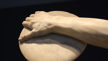
Discus, Discobolus Lancellotti
A detail of the Discobolus Lancellotti in Parian marble. This is the most complete example from antiquity of the discobolus type statue, all of which were based on an original Greek bronze of c. 450 BCE by Myron. This example dates to the...
Image
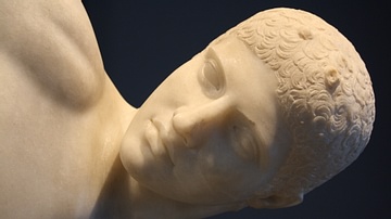
Head, Discobolus Lancellotti
The Discobolus Lancellotti in Parian marble. This is the most complete example from antiquity of the discobolus type statue, all of which were based on an original Greek bronze of c. 450 BCE by Myron. This example dates to the 2nd century...
Image
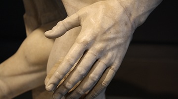
Detail, Discobolus Lancellotti
A detail of the Discobolus Lancellotti in Parian marble. This is the most complete example from antiquity of the discobolus type statue, all of which were based on an original Greek bronze of c. 450 BCE by Myron. This example dates to the...

Image
Discus Thrower (Discobolus Lancellotti)
The Discobolus Lancellotti in Parian marble. This is the most complete example from antiquity of the discobolus type statue, all of which were based on an original Greek bronze of c. 450 BCE by Myron. This example dates to the 2nd century...
Image
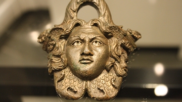
Roman Bronze Bucket Handle
A Roman bronze bucket handle in the form of Medusa. Date unknown. Excavated from the theatre of Aosta, northern Italy. (Archaeological Museum, Aosta)
Image
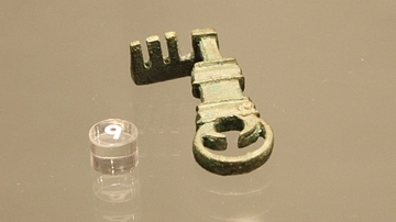
Roman Bronze Key
A Roman bronze key from the western cemetery of Aosta, northern Italy. Date unknown. (Archaeological Museum, Aosta)

Image
Caesar in Gaul
Artist's impression of how Caesar and his army marching through Gaul may have looked like. This is a marketing picture for the Rome II: Total War DLC "Caesar in Gaul".
Image
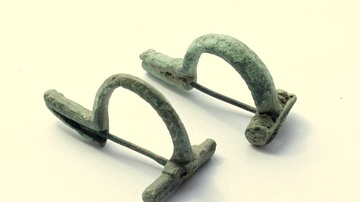
Roman Fibulae
Two P-shape bronze fibulae. 2nd-3rd century CE. Provenance unknown. (private collection)
Image
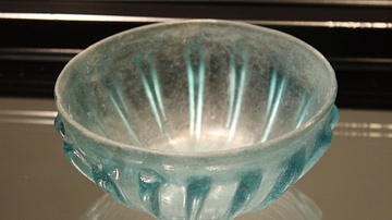
Roman Glass Bowl, Aosta
A Roman glass bowl or cup with moulded ribs. From the western cemetery of Aosta, northern Italy. Mid-1st century CE. (Archaeological Museum, Aosta)
Image
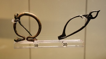
Roman Bronze Brooches
Two Roman brooches made from bronze. The left is an example of an 'omega' brooch whilst the right is an example of the 'pincer' type. 3rd century CE. (Archaeological Museum, Aosta)