
Search Images
Browse Content (p. 1795)
Image
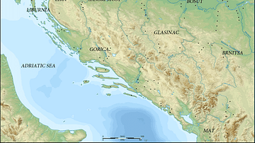
Map of Prehistoric Illyria
A map showing the sites and cultures of prehistoric Illyria.

Image
Map of the Illyrian Tribes
A map showing the Illyrian tribes prior to Roman conquest, including Phrygian tribes, Venetic tribes, independent tribes, and those under Celtic influence.
Image
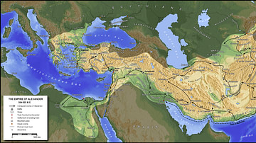
The Empire of Alexander the Great
A map showing the Empire of Alexander the Great, his conquests, and the routes he took (334 BC - 323 BC). Major cities, roads, and battles are indicated.
Image
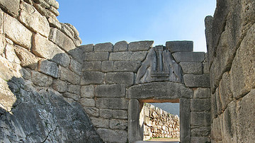
Lion's Gate at Mycenae
The famous Lion's Gate in the ruins of Mycenae.
Image
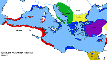
Map of the Mediterranean 550 BC
A map of the Mediterranean around 550 BC, showing the major cultures:
Greece and its colonies
Phoenicia and its colonies
Lydia
Egypt
Persia
Thrace
Illyria
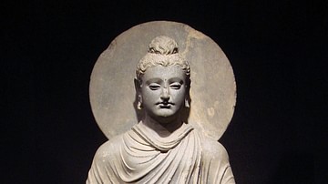
Image
Buddha Statue, Gandhara
One of the first representations of the Buddha, 1st-2nd century CE, Gandhara: Standing Buddha. (Tokyo National Museum)

Image
Buddha with Hercules Protector
Heracles depiction of Vajrapani as the protector of the Buddha,
2nd century AD Gandhara, British Museum.
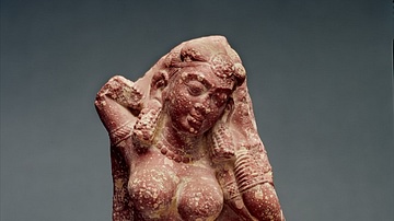
Image
Yakshi
Mathura region: Yakshi, ca. second century CE: sandstone. The William A. Whitaker Foundation Art Fund. Republished with permission from the Ackland Art Museum. Credit: 84.2.1 Unidentified Artist Indian, Mathura region: Yakshi, 2nd...
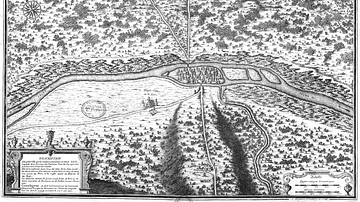
Image
Map of Lutetia
A 18th century map of Lutetia by Jean-Baptiste Bourguignon d'Anville (1697–1782).
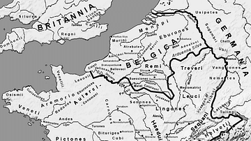
Image
Map of Gaul
A map of Gaul indicating the local tribes, regions, and cities, circa 54 BCE.