
Search Images
Browse Content (p. 1637)
Image
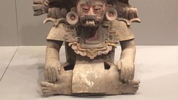
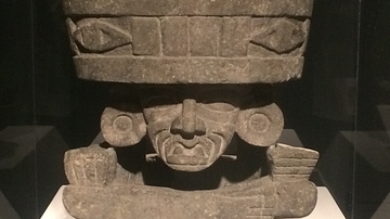
Zapotec Priest Figure
A ceramic figure-vessel representing a priest of the Zapotec civilization. Oaxaca, Mexico, 250-600 CE. The figure wears a mask, feathered headdress, and a medallion which represents a maize field. (St. Louis Art Museum, Missouri)

Image
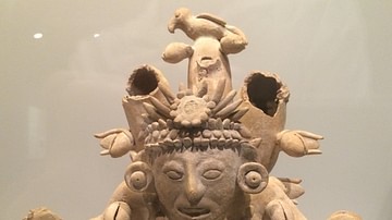
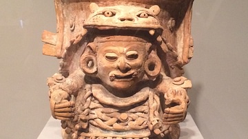
Female Zapotec Figure
A ceramic vessel in the form of a seated figure from the Zapotec civilization. Oaxaca, Mexico, 250-600 CE. The figure's jewellery and filed front teeth indicate a high social status. (St. Louis Art Museum, Missouri)
Image
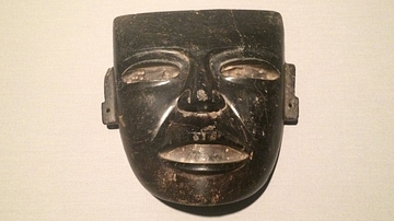
Stone Mask, Teotihuacan
A stone mask from Teotihuacan, 250-600 CE. (St. Louis Art Museum, Missouri)
Image
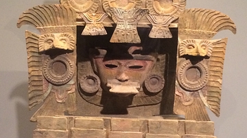
Teotihuacan Incense Burner
A painted ceramic incense burner from Teotihuacan, c. 350-450 CE. It is decorated with feather shields, birds, and butterflies in ceramic. (St. Louis Art Museum, Missouri)
Image
Maya Diving Figure
A Maya diving figure from a lid of a ceramic vessel. Mexico, c. 1000-1100 CE. (St. Louis Art Museum, Missouri)
Image
Teotihuacan Old God
A basalt brazier in the form of the Teotihuacan Old God. Teotihuacan, Early Classic Period, c. 400-500 CE. (St. Louis Art Museum, Missouri)
Image
Maya Incense Burner
A Maya incense burner in the form of Itzamnaaj. The god wears a costume with feline headdress. Painted ceramic, c. 1200-1521, Peten, Guatemala (St. Louis Art Museum, Missouri)
Image
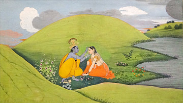
Krishna & Radha
An idyllic scene depicting the Hindu hero Krishna and his wife Radha. 18th century CE opaque watercolour with gold on paper. (Musée Guimet, Paris)
Image
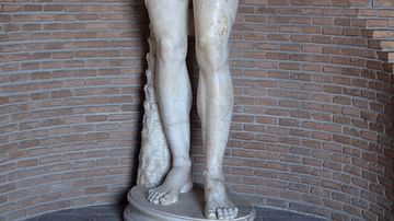
Antinous as Osiris
Statue of Antinous as Osiris in white marble, 131-138 CE, probably found in the Antinoeion at Hadrian's Villa (a sanctuary dedicated to Antinous). Now in Vatican Museums (Gregorian Egyptian Museum).
Image
Marcus Annaeus Lucanus
Marcus Annaeus Lucanus, grandson of Seneca the Elder and nephew of Seneca the Younger, was a Roman statesman and Latin poet. Lucan was honoured with a prize at the first Neronian Games in 60 CE for a poem praising Nero and was known for the...