
Search
Did you mean: Oceanus?
Remove Ads
Advertisement
Summary 
Loading AI-generated summary based on World History Encyclopedia articles ...
Search Results
Article
Polynesian Navigation & Settlement of the Pacific
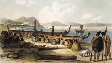
Polynesian navigation of the Pacific Ocean and its settlement began thousands of years ago. The inhabitants of the Pacific islands had been voyaging across vast expanses of ocean water sailing in double canoes or outriggers using nothing...
Definition
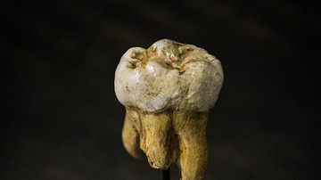
Denisovan
The Denisovans are an extinct group of fossil humans who, along with their sister group the Neanderthals, also share an ancestor with Homo sapiens. Thus far, they are known only from Denisova Cave in the Altai Mountains in Siberia, where...
Definition
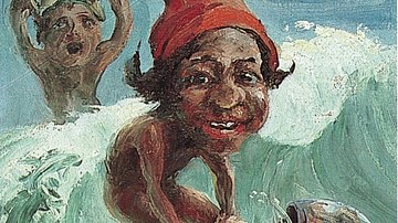
Menehune
Menehune is the term applied to short-statured, forest-dwelling creatures of Hawaiian mythology and is part of a common mythology throughout Polynesia that describes secretive, supernatural beings with human-like attributes. Mysterious supernatural...

Article
Hei Tiki
The hei tiki is a small personal adornment, fashioned by hand from tough pounamu (New Zealand greenstone or nephrite jade), and is worn around the neck. Hei means something looped around the neck, and tiki is a generic word used throughout...
Article
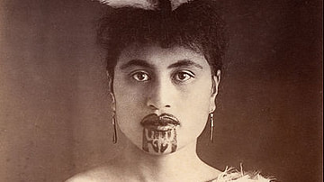
Traditional Maori Tattoo of New Zealand
Te Papa Tongawera (or simply Te Papa) is New Zealand's innovative national museum situated near the foreshore of beautiful Wellington harbour. Te Papa Tongawera means “container of treasures” in Te Reo Maori, which is the indigenous language...
Interview
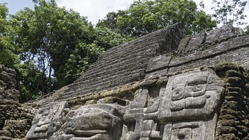
Interview: Preclassic Maya
The genesis of Maya civilization in Mesoamerica was marked by an effervescence in the arts, the beginnings of their written language with glyphs, and a great attention to detail in the sphere of urban planning. Yet, despite these tremendous...

Definition
William Dampier
William Dampier (1651-1715) was an English explorer, navigator, and naturalist, who was the first person to circumnavigate the world three times. He was also among the first Englishmen to step foot on Australian soil when he sailed into King...
Definition
Kukii Heiau
Located at the easternmost point of the Hawaiian Islands, Cape Kumukahi holds a special place in ancient Hawaiian mythology as this was where the gods and goddesses first arrived in the islands from Tahiti. It was here that the fire goddess...
Image
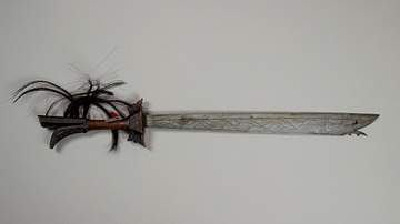
Kampilan Sword
A Kampilan sword, traditionally used by various ethno-cultural groups in the Philippines and other parts of Oceania. From Sulawesi Utara, Indonesia. Steel blade with wooden hilt, decorated with hair and metal. c. 18th-19th Century CE. 67.9...
Definition
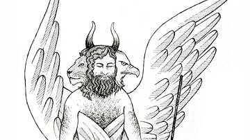
Cherub
A cherub (pl. cherubim) was a divine being who dwelt in the heavenly realm of the gods, either as a servant or a mediator between humans and the divine. The word most likely derived from the Akkadian karabu ("to bless"). The cherubim are...