
Illustration
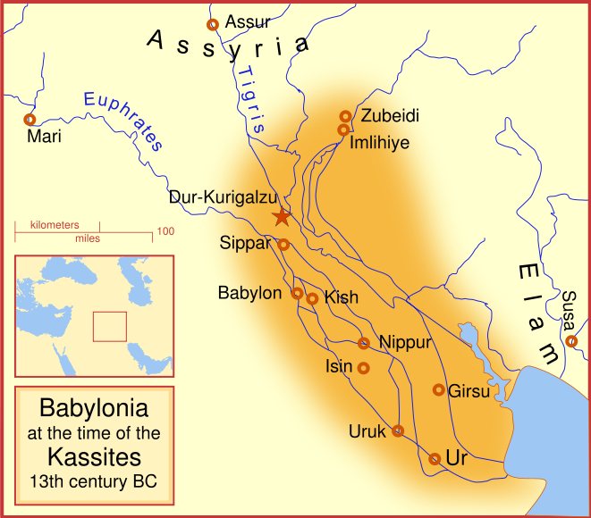
A map of the Babylonian Empire during the time of the Kassites, roughly the 13th century BC. This map shows the probable river courses and coastline at that time.
Related Images
Image
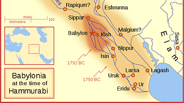
Babylon at the time of Hammurabi
A locator map of Hammurabi's Babylonia, showing the Babylonian...
Image
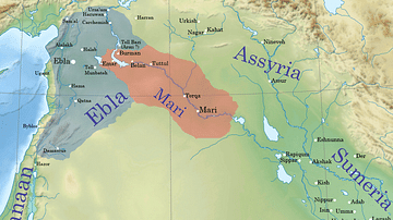
Ebla and Mari during the reign of Iblul-Il of Mari
This map shows Ebla and Mari's territories c. 2380 BCE. The two...
Image
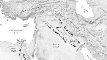
Tigris, Euphrates, & Nile River Flows
Map showing the Tigris and Euphrates Rivers flowing from north...
Image
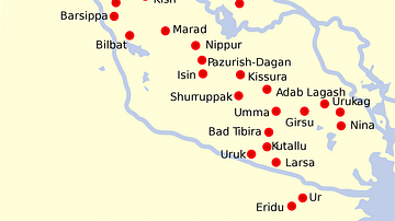
Map of Sumer and Elam
Map with the locations of the main cities of Sumer and Elam.
Image
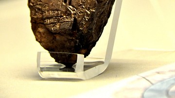
Map of the World from Sippar, Mesopotamia
This tablet contains both a cuneiform inscription and a unique...
Image
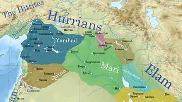
Ancient Syro-Mesopotamia ca. 1764 BCE
This map shows the political situation in Syro-Mesopotamia c. 1764...
References
- File:Kassite Babylonia EN.svg - Wikipedia, the free encyclopediaAccessed 1 Dec 2016.
Cite This Work
APA Style
MapMaster, . (2012, April 26). Babylon at the time of the Kassites. World History Encyclopedia. Retrieved from https://www.worldhistory.org/image/75/babylon-at-the-time-of-the-kassites/
Chicago Style
MapMaster, . "Babylon at the time of the Kassites." World History Encyclopedia. Last modified April 26, 2012. https://www.worldhistory.org/image/75/babylon-at-the-time-of-the-kassites/.
MLA Style
MapMaster, . "Babylon at the time of the Kassites." World History Encyclopedia. World History Encyclopedia, 26 Apr 2012. Web. 15 Apr 2024.