


A map showing Iberian peninsula in 125 AD including important roads, locations of legions and gold (Au) and silver (Ag) mines.
Related Images
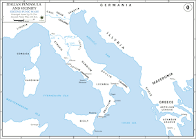
Italian Penninsula

Map of Roman Hispania c. 125 CE

Map of the Roman Empire in 125 CE

Map of the Travels of Hadrian & the Roman Empire c. 125 CE

The Journey of Hadrian 121-125 CE - An Emperor on the Move: Defense and Diplomacy in the Roman World
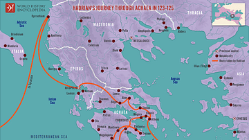
Hadrian's Journey through Achaea, 123-125
Cite This Work
APA Style
nacu, A. (2012, April 26). Map of the Iberian Penninsula in 125 AD. World History Encyclopedia. https://www.worldhistory.org/image/270/map-of-the-iberian-penninsula-in-125-ad/
Chicago Style
nacu, Andrei. "Map of the Iberian Penninsula in 125 AD." World History Encyclopedia, April 26, 2012. https://www.worldhistory.org/image/270/map-of-the-iberian-penninsula-in-125-ad/.
MLA Style
nacu, Andrei. "Map of the Iberian Penninsula in 125 AD." World History Encyclopedia, 26 Apr 2012, https://www.worldhistory.org/image/270/map-of-the-iberian-penninsula-in-125-ad/.